Hastings night lights from space
Night Light of Hastings (Hawke's Bay) from space (New Zealand) Src. Average luminocity for 10x10km area is 40.6445% and for 50x50km: 4.3466%.
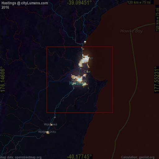
Analysis of Hastings night lights 2016
Square area 10x10 km:
 4.38%
4.38%90-99
7.79%80-89
6.17%70-79
4.87%60-69
4.55%50-59
7.79%40-49
1.79%30-39
8.12%20-29
10.55%10-19
41.88%0-9
2.11%Square area 50x50 km:
0.37%90-99
0.96%80-89
0.6%70-79
0.31%60-69
0.42%50-59
0.44%40-49
0.28%30-39
0.79%20-29
0.97%10-19
5.44%0-9
89.42%Clear (daylight) street map image can be seen on geolist.org.
Map coordinates:
39° 5' 40.2" South, 176° 8' 45.8" East
39° 38' 17.2" South, 176° 50' 57" East
40° 10' 38.8" South, 177° 33' 8.3" East
Some cities around Hastings sort by population:
• Palmerston North
132.3 km =82.2 mi,  232°
232°
• Napier
17.1 km =10.6 mi,  18°
18°
• Wanganui
157.2 km =97.7 mi,  257°
257°
• Gisborne
148 km =92 mi,  42°
42°
• Taupo
125 km =77.7 mi,  328°
328°
• Taradale
11.6 km =7.2 mi,  0°
0°
• Kawerau
171.5 km =106.6 mi,  355°
355°
• Linton Military Camp
137.3 km =85.3 mi, 231°
2190224 (p: 61,696)
Sources (retrieved 2019-11-25):
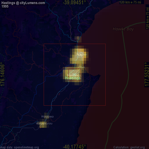
» NASA, Earths city lights 1995
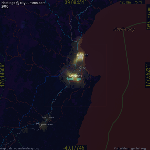
» NASA city lights 2003
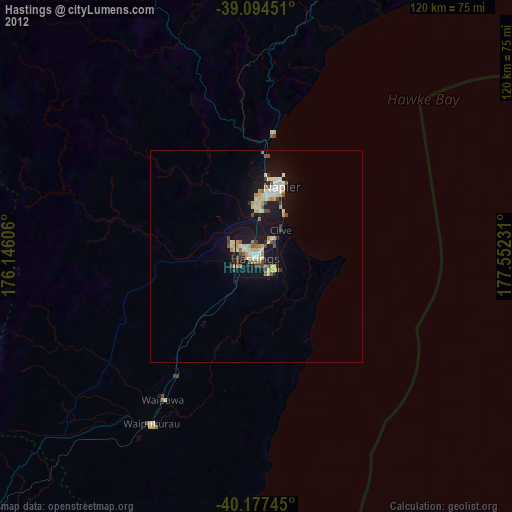
» Earth at Night: Flat Maps 2012, 2016