Mahendranagar night lights from space
Night Light of Mahendranagar (Sudurpashchim Pradesh) from space (Nepal) Src. Average luminocity for 10x10km area is 4.4385% and for 50x50km: 3.3331%.
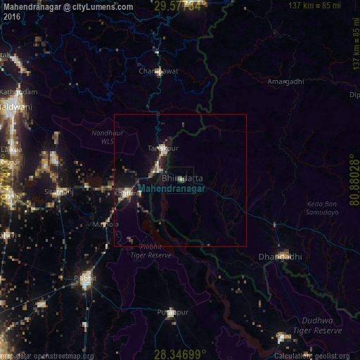
Analysis of Mahendranagar night lights 2016
Square area 10x10 km:
 0%
0%90-99
0%80-89
0.79%70-79
0%60-69
0%50-59
1.59%40-49
1.98%30-39
1.19%20-29
2.38%10-19
0.79%0-9
91.27%Square area 50x50 km:
0.23%90-99
0.48%80-89
0.26%70-79
0.08%60-69
0.34%50-59
0.53%40-49
0.85%30-39
0.75%20-29
0.81%10-19
3.43%0-9
92.23%Clear (daylight) street map image can be seen on geolist.org.
Map coordinates:
29° 34' 38.4" North, 79° 28' 26.5" East
28° 57' 50.4" North, 80° 10' 37.7" East
28° 20' 49.2" North, 80° 52' 49" East
Some cities around Mahendranagar sort by population:
• Dhangaḍhi̇̄
49.7 km =30.9 mi,  126°
126°
• Pūranpur, IN
50.2 km =31.2 mi,  183°
183°
• Sitārganj, IN
46.2 km =28.7 mi,  265°
265°
• Tanakpur, IN
13.8 km =8.6 mi,  332°
332°
• Khatīma, IN
20.6 km =12.8 mi,  256°
256°
• Kālīnagar, IN
39.3 km =24.4 mi,  193°
193°
• Banbasa, IN
10.3 km =6.4 mi,  287°
287°
• Lohaghāt, IN
49.6 km =30.8 mi,  350°
350°
1283095 (p: 88,381)
Sources (retrieved 2019-11-25):
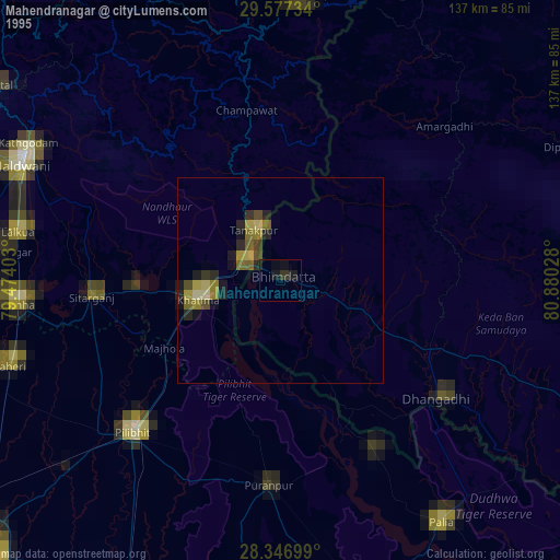
» NASA, Earths city lights 1995
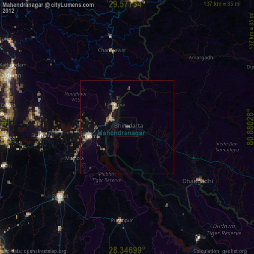
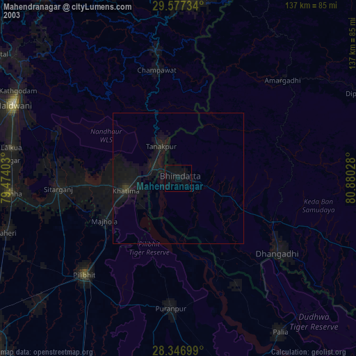
» NASA city lights 2003
» Earth at Night: Flat Maps 2012, 2016