Lohaghāt night lights from space
Night Light of Lohaghāt (Uttarakhand) from space (India) Src. Average luminocity for 10x10km area is 2.9905% and for 50x50km: 2.5504%.
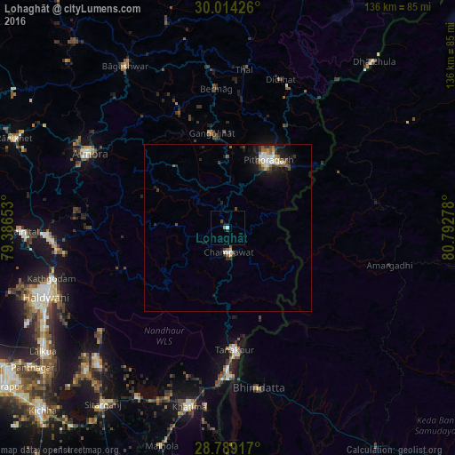
Analysis of Lohaghāt night lights 2016
Square area 10x10 km:
 0.57%
0.57%90-99
0.19%80-89
0%70-79
0%60-69
0.76%50-59
0%40-49
0.76%30-39
0%20-29
0.76%10-19
1.89%0-9
95.08%Square area 50x50 km:
0.31%90-99
0.37%80-89
0.35%70-79
0.19%60-69
0.22%50-59
0.39%40-49
0.43%30-39
0.52%20-29
0.52%10-19
2.23%0-9
94.48%Clear (daylight) street map image can be seen on geolist.org.
Map coordinates:
30° 0' 51.3" North, 79° 23' 11.5" East
29° 24' 12.8" North, 80° 5' 22.7" East
28° 47' 21" North, 80° 47' 34" East
Some cities around Lohaghāt sort by population:
• Mahendranagar, NP
49.6 km =30.8 mi,  170°
170°
• Pithorāgarh
23.1 km =14.4 mi,  30°
30°
• Almora
46.9 km =29.1 mi,  297°
297°
• Dadeldhurā, NP
49 km =30.4 mi,  103°
103°
• Tanakpur
36.7 km =22.8 mi,  176°
176°
• Khatīma
54.8 km =34.1 mi,  192°
192°
• Banbasa
45.9 km =28.5 mi, 181°
• Bhīm Tāl
51.4 km =31.9 mi,  262°
262°
1264850 (p: 6,758)
Sources (retrieved 2019-11-25):
» Earth at Night: Flat Maps 2012, 2016