Bairāgnia night lights from space
Night Light of Bairāgnia (Bihar) from space (India) Src. Average luminocity for 10x10km area is 31.5218% and for 50x50km: 6.9121%.
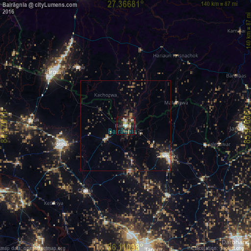
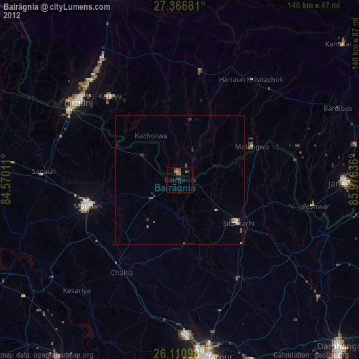
Analysis of Bairāgnia night lights 2016
Square area 10x10 km:
 4.17%
4.17%90-99
2.98%80-89
3.37%70-79
3.57%60-69
2.78%50-59
8.73%40-49
7.34%30-39
4.96%20-29
6.94%10-19
31.55%0-9
23.61%Square area 50x50 km:
0.54%90-99
0.56%80-89
0.37%70-79
0.44%60-69
0.76%50-59
1.3%40-49
1.69%30-39
1.75%20-29
3.06%10-19
5.73%0-9
83.81%Clear (daylight) street map image can be seen on geolist.org.
Map coordinates:
27° 22' 0.5" North, 84° 34' 12.4" East
26° 44' 26.3" North, 85° 16' 23.6" East
26° 6' 39.5" North, 85° 58' 34.9" East
Some cities around Bairāgnia sort by population:
• Mothīhāri
36.9 km =22.9 mi,  253°
253°
• Sītāmarhi
27.1 km =16.8 mi,  127°
127°
• Dhāka
12.8 km =8 mi,  235°
235°
• Gaur, NP
2.7 km =1.7 mi,  10°
10°
• Sheohar
25.3 km =15.7 mi,  175°
175°
• Malaṅgawā, NP
31.2 km =19.4 mi,  65°
65°
• Belsand
35.4 km =22 mi,  158°
158°
• Dumra
31.2 km =19.4 mi, 128°
1277748 (p: 37,465)
Sources (retrieved 2019-11-25):
» Earth at Night: Flat Maps 2012, 2016