Ålesund night lights from space
Night Light of Ålesund (Møre og Romsdal) from space (Norway) Src. Average luminocity for 10x10km area is 31.7549% and for 50x50km: 5.5252%.
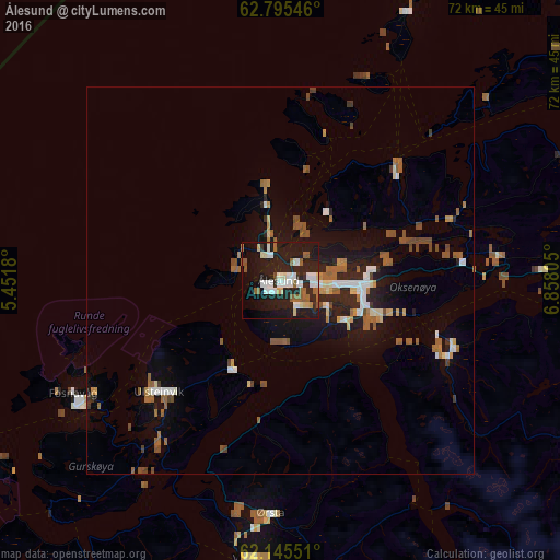
Analysis of Ålesund night lights 2016
Square area 10x10 km:
 5.43%
5.43%90-99
8.5%80-89
2.67%70-79
0.99%60-69
1.48%50-59
6.32%40-49
1.28%30-39
0.79%20-29
12.65%10-19
40.12%0-9
19.76%Square area 50x50 km:
0.67%90-99
0.83%80-89
0.45%70-79
0.42%60-69
0.59%50-59
1.43%40-49
0.83%30-39
0.23%20-29
1.4%10-19
4.57%0-9
88.57%Clear (daylight) street map image can be seen on geolist.org.
Map coordinates:
62° 47' 43.7" North, 5° 27' 6.5" East
62° 28' 20.1" North, 6° 9' 17.7" East
62° 8' 43.8" North, 6° 51' 29" East
Some cities around Ålesund sort by population:
• Molde
59.2 km =36.8 mi,  60°
60°
• Kristiansund
106.9 km =66.4 mi,  48°
48°
• Førde
114.5 km =71.1 mi,  187°
187°
• Florø
113.3 km =70.4 mi,  211°
211°
• Sogndal
146.8 km =91.2 mi,  160°
160°
• Ørsta
30.3 km =18.8 mi,  182°
182°
• Volda
36.5 km =22.7 mi, 186°
• Ulsteinvik
21.3 km =13.2 mi,  227°
227°
3163392 (p: 44,096)
Sources (retrieved 2019-11-25):
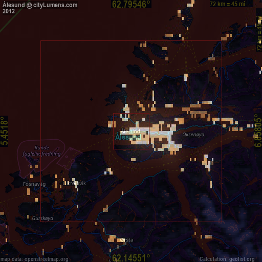
» Earth at Night: Flat Maps 2012, 2016