Wisch night lights from space
Night Light of Wisch (Gelderland) from space (Netherlands) Src. Average luminocity for 10x10km area is 11.6098% and for 50x50km: 8.4488%.
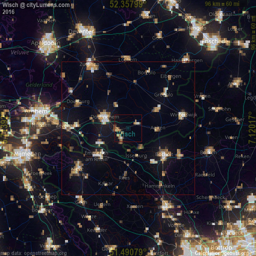
Analysis of Wisch night lights 2016
Square area 10x10 km:
 0.63%
0.63%90-99
1.39%80-89
1.39%70-79
1.26%60-69
4.29%50-59
2.15%40-49
0.76%30-39
1.52%20-29
0.13%10-19
3.41%0-9
83.08%Square area 50x50 km:
0.65%90-99
1.23%80-89
0.72%70-79
0.88%60-69
1.31%50-59
1.56%40-49
1.26%30-39
0.64%20-29
0.89%10-19
6.77%0-9
84.09%Clear (daylight) street map image can be seen on geolist.org.
Map coordinates:
52° 21' 28.8" North, 5° 42' 50.1" East
51° 55' 35.3" North, 6° 25' 1.4" East
51° 29' 26.8" North, 7° 7' 12.6" East
Some cities around Wisch sort by population:
• Bocholt, DE
16.7 km =10.4 mi,  125°
125°
• Doetinchem
9.8 km =6.1 mi,  295°
295°
• Emmerich, DE
15.1 km =9.4 mi,  230°
230°
• Lichtenvoorde
12.2 km =7.6 mi,  56°
56°
• Aalten
11.2 km =7 mi,  90°
90°
• Isselburg, DE
11 km =6.8 mi,  162°
162°
• Zelhem
10.1 km =6.3 mi,  332°
332°
• Varsseveld
3.4 km =2.1 mi, 56°
2744324 (p: 19,496)
Sources (retrieved 2019-11-25):
» Earth at Night: Flat Maps 2012, 2016