Oudewater night lights from space
Night Light of Oudewater (Utrecht) from space (Netherlands) Src. Average luminocity for 10x10km area is 7.6894% and for 50x50km: 38.3863%.
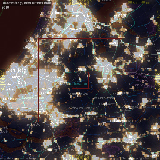
Analysis of Oudewater night lights 2016
Square area 10x10 km:
 0.38%
0.38%90-99
1.14%80-89
0%70-79
1.01%60-69
0.25%50-59
1.26%40-49
0.51%30-39
0.25%20-29
0%10-19
15.03%0-9
80.18%Square area 50x50 km:
10.76%90-99
9.14%80-89
3.06%70-79
2.99%60-69
3.31%50-59
3.57%40-49
4.8%30-39
5.61%20-29
9.4%10-19
15.7%0-9
31.67%Clear (daylight) street map image can be seen on geolist.org.
Map coordinates:
52° 27' 20" North, 4° 9' 53.8" East
52° 1' 30" North, 4° 52' 5" East
51° 35' 24.9" North, 5° 34' 16.3" East
Some cities around Oudewater sort by population:
• Gouda
11 km =6.8 mi,  265°
265°
• Woerden
6.8 km =4.2 mi,  8°
8°
• Bodegraven
10.3 km =6.4 mi,  308°
308°
• Lopik
8 km =5 mi,  136°
136°
• Reeuwijk
10.1 km =6.3 mi,  283°
283°
• Schoonhoven
8.7 km =5.4 mi,  188°
188°
• Liesveld
10.6 km =6.6 mi, 193°
• Montfoort
6.2 km =3.9 mi,  68°
68°
2748979 (p: 9,836)
Sources (retrieved 2019-11-25):
» Earth at Night: Flat Maps 2012, 2016