Liesveld night lights from space
Night Light of Liesveld (South Holland) from space (Netherlands) Src. Average luminocity for 10x10km area is 9.2866% and for 50x50km: 36.7483%.
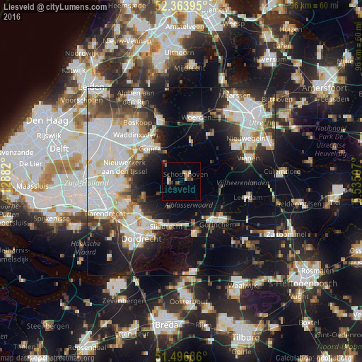
Analysis of Liesveld night lights 2016
Square area 10x10 km:
 0.25%
0.25%90-99
1.52%80-89
0.88%70-79
1.39%60-69
1.01%50-59
2.27%40-49
1.64%30-39
1.64%20-29
0.13%10-19
0.88%0-9
88.38%Square area 50x50 km:
11.78%90-99
8.85%80-89
2.8%70-79
2.57%60-69
2.71%50-59
3.03%40-49
3.77%30-39
4.44%20-29
6.72%10-19
17.55%0-9
35.77%Clear (daylight) street map image can be seen on geolist.org.
Map coordinates:
52° 21' 50.2" North, 4° 7' 43.8" East
51° 55' 57" North, 4° 49' 55" East
51° 29' 48.7" North, 5° 32' 6.3" East
Some cities around Liesveld sort by population:
• Gouda
12.6 km =7.8 mi,  317°
317°
• Sliedrecht
13 km =8.1 mi,  197°
197°
• Lopik
9.1 km =5.7 mi,  60°
60°
• Schoonhoven
2 km =1.2 mi,  34°
34°
• Oudewater
10.6 km =6.6 mi,  13°
13°
• Nieuw-Lekkerland
11.1 km =6.9 mi,  244°
244°
• Neder-Hardinxveld
11.6 km =7.2 mi,  172°
172°
• Giessendam
11.1 km =6.9 mi,  178°
178°
2751621 (p: 9,767)
Sources (retrieved 2019-11-25):
» Earth at Night: Flat Maps 2012, 2016