Nijmegen night lights from space
Night Light of Nijmegen (Gelderland) from space (Netherlands) Src. Average luminocity for 10x10km area is 58.8053% and for 50x50km: 21.7336%.
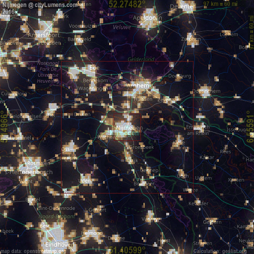
Analysis of Nijmegen night lights 2016
Square area 10x10 km:
 14.99%
90-99
16.81%80-89
7.28%70-79
3.36%60-69
3.78%50-59
7.7%40-49
5.32%30-39
12.18%20-29
16.67%10-19
11.62%0-9
0.28%Square area 50x50 km:
2.7%90-99
3.52%80-89
2.38%70-79
2.28%60-69
2.96%50-59
2.81%40-49
2.69%30-39
3.18%20-29
7.06%10-19
20.07%0-9
50.35%Clear (daylight) street map image can be seen on geolist.org.
Map coordinates:
52° 16' 29.4" North, 5° 8' 58.8" East
51° 50' 33" North, 5° 51' 10" East
51° 24' 21.6" North, 6° 33' 21.3" East
Some cities around Nijmegen sort by population:
• Beuningen
6.3 km =3.9 mi,  289°
289°
• Elst
8.6 km =5.3 mi,  354°
354°
• Lindenholt
4.2 km =2.6 mi,  255°
255°
• Bemmel
6.3 km =3.9 mi,  29°
29°
• Hatert
4.3 km =2.7 mi,  200°
200°
• Lent
2.3 km =1.4 mi,  24°
24°
• Hengstdal
2.3 km =1.4 mi,  115°
115°
• Gendt
9 km =5.6 mi,  64°
64°
2750053 (p: 158,732)
Sources (retrieved 2019-11-25):
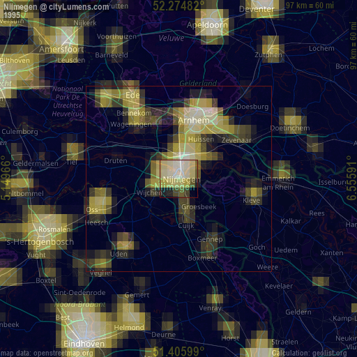
» NASA, Earths city lights 1995
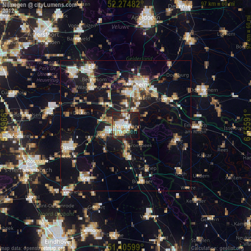
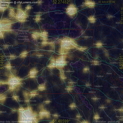
» NASA city lights 2003
» Earth at Night: Flat Maps 2012, 2016