Lindenholt night lights from space
Night Light of Lindenholt (Gelderland) from space (Netherlands) Src. Average luminocity for 10x10km area is 64.1989% and for 50x50km: 22.5008%.
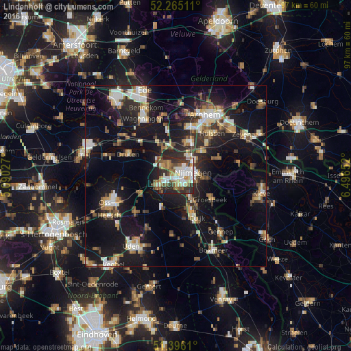
Analysis of Lindenholt night lights 2016
Square area 10x10 km:
 13.87%
90-99
16.95%80-89
7.84%70-79
7%60-69
7.7%50-59
11.06%40-49
6.86%30-39
12.89%20-29
14.85%10-19
0.98%0-9
0%Square area 50x50 km:
2.87%90-99
3.73%80-89
2.41%70-79
2.36%60-69
3.07%50-59
2.86%40-49
2.75%30-39
3.26%20-29
6.81%10-19
21.54%0-9
48.33%Clear (daylight) street map image can be seen on geolist.org.
Map coordinates:
52° 15' 54.4" North, 5° 5' 25" East
51° 49' 57.7" North, 5° 47' 36.2" East
51° 23' 46" North, 6° 29' 47.5" East
Some cities around Lindenholt sort by population:
• Nijmegen
4.2 km =2.6 mi,  75°
75°
• Wijchen
5.4 km =3.4 mi,  240°
240°
• Beuningen
3.6 km =2.2 mi,  329°
329°
• Grave
9 km =5.6 mi,  204°
204°
• Bemmel
9.8 km =6.1 mi,  47°
47°
• Hatert
3.9 km =2.4 mi,  138°
138°
• Lent
6 km =3.7 mi,  57°
57°
• Hengstdal
6.2 km =3.9 mi,  89°
89°
2751582 (p: 16,121)
Sources (retrieved 2019-11-25):
» Earth at Night: Flat Maps 2012, 2016