Edam night lights from space
Night Light of Edam (North Holland) from space (Netherlands) Src. Average luminocity for 10x10km area is 15.9378% and for 50x50km: 28.2884%.
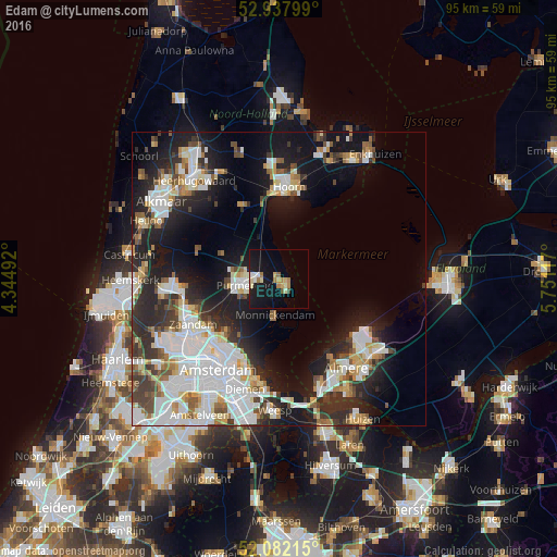
Analysis of Edam night lights 2016
Square area 10x10 km:
 0.53%
0.53%90-99
3.17%80-89
3.04%70-79
1.59%60-69
3.44%50-59
0.79%40-49
0.66%30-39
0%20-29
0.66%10-19
25.26%0-9
60.85%Square area 50x50 km:
7.64%90-99
6.55%80-89
2.38%70-79
2.34%60-69
2.75%50-59
2.49%40-49
2.67%30-39
3.51%20-29
7.73%10-19
15.49%0-9
46.44%Clear (daylight) street map image can be seen on geolist.org.
Map coordinates:
52° 56' 16.8" North, 4° 20' 41.7" East
52° 30' 43.7" North, 5° 2' 53" East
52° 4' 55.7" North, 5° 45' 4.2" East
Some cities around Edam sort by population:
• Amsterdam
18.7 km =11.6 mi,  214°
214°
• Almere Stad
19.4 km =12.1 mi,  144°
144°
• Zaanstad
17.2 km =10.7 mi,  247°
247°
• Purmerend
6 km =3.7 mi,  262°
262°
• Zaandam
17.1 km =10.6 mi,  241°
241°
• Hoorn
14.5 km =9 mi,  3°
3°
• Volendam
2.5 km =1.6 mi, 141°
• Zaandijk
16.8 km =10.4 mi, 255°
2756431 (p: 7,380)
Sources (retrieved 2019-11-25):
» Earth at Night: Flat Maps 2012, 2016