Boxtel night lights from space
Night Light of Boxtel (North Brabant) from space (Netherlands) Src. Average luminocity for 10x10km area is 17.9425% and for 50x50km: 28.9233%.
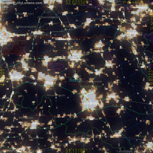
Analysis of Boxtel night lights 2016
Square area 10x10 km:
 1.34%
1.34%90-99
2.94%80-89
1.47%70-79
0.4%60-69
0.27%50-59
2.14%40-49
2.27%30-39
2.81%20-29
2.81%10-19
42.38%0-9
41.18%Square area 50x50 km:
5.04%90-99
5.7%80-89
2.45%70-79
2.89%60-69
3.28%50-59
3.42%40-49
2.89%30-39
4.04%20-29
10.21%10-19
27.32%0-9
32.76%Clear (daylight) street map image can be seen on geolist.org.
Map coordinates:
52° 1' 32" North, 4° 37' 33.8" East
51° 35' 27" North, 5° 19' 45" East
51° 9' 6.8" North, 6° 1' 56.3" East
Some cities around Boxtel sort by population:
• 's-Hertogenbosch
12.2 km =7.6 mi,  351°
351°
• Best
10.2 km =6.3 mi,  155°
155°
• Oisterwijk
9.8 km =6.1 mi,  262°
262°
• Vught
7.5 km =4.7 mi,  337°
337°
• Schijndel
7.9 km =4.9 mi,  63°
63°
• Sint-Oedenrode
9.4 km =5.8 mi,  106°
106°
• Oirschot
9.6 km =6 mi,  186°
186°
• Heeswijk-Dinther
12.1 km =7.5 mi, 56°
2758460 (p: 29,511)
Sources (retrieved 2019-11-25):
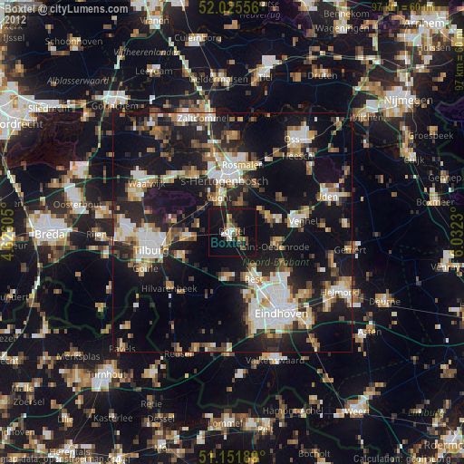
» Earth at Night: Flat Maps 2012, 2016