Tipitapa night lights from space
Night Light of Tipitapa (Managua) from space (Nicaragua) Src. Average luminocity for 10x10km area is 22.7727% and for 50x50km: 13.7409%.
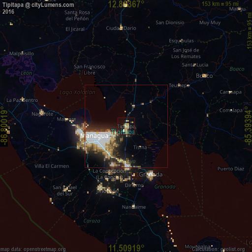
Analysis of Tipitapa night lights 2016
Square area 10x10 km:
 0.83%
0.83%90-99
1.86%80-89
1.86%70-79
6.2%60-69
6.2%50-59
2.69%40-49
0.83%30-39
3.31%20-29
3.1%10-19
26.03%0-9
47.11%Square area 50x50 km:
2.98%90-99
2.53%80-89
1.41%70-79
1.55%60-69
1.79%50-59
1.9%40-49
1.37%30-39
2.26%20-29
3.87%10-19
6.42%0-9
73.91%Clear (daylight) street map image can be seen on geolist.org.
Map coordinates:
12° 53' 1.2" North, 86° 48' 0.7" West
12° 11' 50.4" North, 86° 5' 49.4" West
11° 30' 33.1" North, 85° 23' 38.2" West
Some cities around Tipitapa sort by population:
• Managua
18.1 km =11.2 mi,  246°
246°
• Masaya
24.8 km =15.4 mi,  179°
179°
• Ciudad Sandino
27.2 km =16.9 mi,  260°
260°
• Ticuantepe
22.7 km =14.1 mi,  211°
211°
• Nindirí
21.7 km =13.5 mi,  186°
186°
• La Concepción
30.6 km =19 mi,  199°
199°
• Nandasmo
30.5 km =19 mi, 184°
• Tisma
15.5 km =9.6 mi,  145°
145°
3616035 (p: 50,000)
Sources (retrieved 2019-11-25):
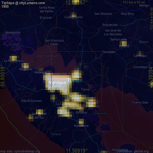
» NASA, Earths city lights 1995
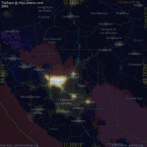
» NASA city lights 2003
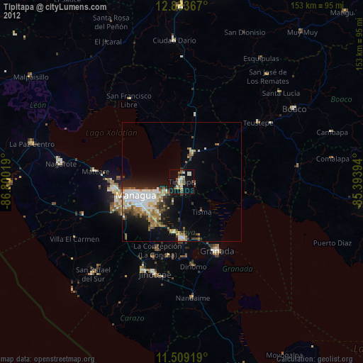
» Earth at Night: Flat Maps 2012, 2016