Ticuantepe night lights from space
Night Light of Ticuantepe (Managua) from space (Nicaragua) Src. Average luminocity for 10x10km area is 42.314% and for 50x50km: 20.3537%.
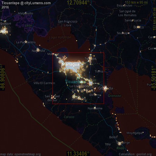
Analysis of Ticuantepe night lights 2016
Square area 10x10 km:
 2.27%
2.27%90-99
5.17%80-89
6.2%70-79
9.92%60-69
8.26%50-59
6.4%40-49
5.17%30-39
12.4%20-29
16.74%10-19
18.39%0-9
9.09%Square area 50x50 km:
3.21%90-99
3.42%80-89
2.37%70-79
2.31%60-69
2.91%50-59
2.98%40-49
2.28%30-39
3.36%20-29
5.35%10-19
13.68%0-9
58.13%Clear (daylight) street map image can be seen on geolist.org.
Map coordinates:
12° 42' 34" North, 86° 54' 29" West
12° 1' 21.5" North, 86° 12' 17.7" West
11° 20' 2.6" North, 85° 30' 6.5" West
Some cities around Ticuantepe sort by population:
• Managua
13.2 km =8.2 mi,  338°
338°
• Masaya
13.2 km =8.2 mi,  113°
113°
• San Marcos
12.6 km =7.8 mi,  179°
179°
• Masatepe
13.7 km =8.5 mi,  151°
151°
• El Crucero
11.9 km =7.4 mi,  252°
252°
• Nindirí
9.3 km =5.8 mi,  102°
102°
• La Concepción
9.7 km =6 mi,  170°
170°
• Nandasmo
14.3 km =8.9 mi,  140°
140°
3616064 (p: 13,209)
Sources (retrieved 2019-11-25):
» Earth at Night: Flat Maps 2012, 2016