Tisma night lights from space
Night Light of Tisma (Masaya) from space (Nicaragua) Src. Average luminocity for 10x10km area is 1.0289% and for 50x50km: 12.753%.
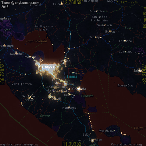
Analysis of Tisma night lights 2016
Square area 10x10 km:
 0%
0%90-99
0%80-89
0%70-79
0.83%60-69
0%50-59
0.41%40-49
0%30-39
0%20-29
0%10-19
0%0-9
98.76%Square area 50x50 km:
1.73%90-99
1.87%80-89
1.44%70-79
1.57%60-69
1.8%50-59
2.04%40-49
1.39%30-39
2.26%20-29
3.68%10-19
9.77%0-9
72.45%Clear (daylight) street map image can be seen on geolist.org.
Map coordinates:
12° 46' 6.9" North, 86° 43' 13.9" West
12° 4' 55" North, 86° 1' 2.6" West
11° 23' 36.7" North, 85° 18' 51.4" West
Some cities around Tisma sort by population:
• Masaya
14.6 km =9.1 mi,  214°
214°
• Granada
18.2 km =11.3 mi,  158°
158°
• Tipitapa
15.5 km =9.6 mi,  325°
325°
• Ticuantepe
21.4 km =13.3 mi,  252°
252°
• Diriomo
23.2 km =14.4 mi,  189°
189°
• Niquinohomo
21.4 km =13.3 mi,  203°
203°
• Nindirí
14.2 km =8.8 mi,  232°
232°
• Nandasmo
20.8 km =12.9 mi, 212°
3616028 (p: 5,182)
Sources (retrieved 2019-11-25):
» Earth at Night: Flat Maps 2012, 2016