El Crucero night lights from space
Night Light of El Crucero (Managua) from space (Nicaragua) Src. Average luminocity for 10x10km area is 2.8202% and for 50x50km: 18.8806%.
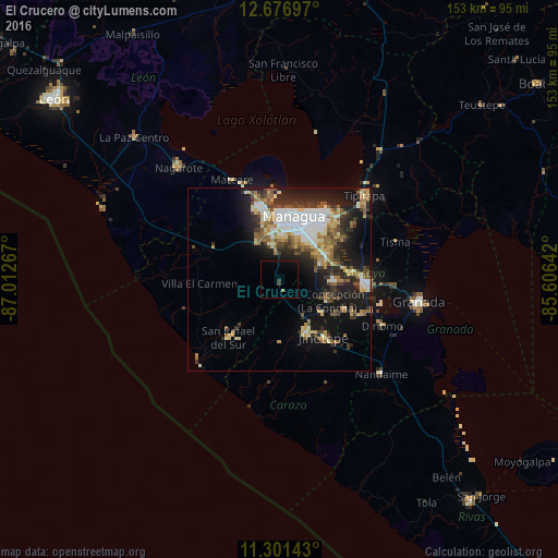
Analysis of El Crucero night lights 2016
Square area 10x10 km:
 0%
0%90-99
0%80-89
0%70-79
0%60-69
0.83%50-59
0%40-49
0.21%30-39
1.45%20-29
0%10-19
2.89%0-9
94.63%Square area 50x50 km:
3.21%90-99
3.37%80-89
2.18%70-79
2.19%60-69
2.76%50-59
2.81%40-49
2.12%30-39
3.26%20-29
4.94%10-19
11.41%0-9
61.76%Clear (daylight) street map image can be seen on geolist.org.
Map coordinates:
12° 40' 37.1" North, 87° 0' 45.6" West
11° 59' 24.3" North, 86° 18' 34.3" West
11° 18' 5.1" North, 85° 36' 23.1" West
Some cities around El Crucero sort by population:
• Managua
17.1 km =10.6 mi,  22°
22°
• Ciudad Sandino
19.1 km =11.9 mi,  348°
348°
• Diriamba
16.5 km =10.3 mi,  152°
152°
• Jinotepe
19.7 km =12.2 mi,  142°
142°
• San Marcos
14.6 km =9.1 mi,  127°
127°
• Ticuantepe
11.9 km =7.4 mi,  72°
72°
• Dolores
18 km =11.2 mi, 145°
• La Concepción
14.3 km =8.9 mi,  114°
114°
3619853 (p: 16,469)
Sources (retrieved 2019-11-25):
» Earth at Night: Flat Maps 2012, 2016