San Carlos night lights from space
Night Light of San Carlos (Río San Juan) from space (Nicaragua) Src. Average luminocity for 10x10km area is 2.8506% and for 50x50km: 0.4254%.
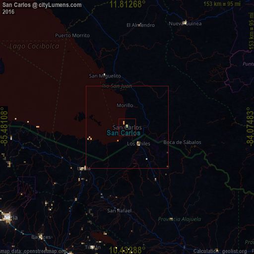
Analysis of San Carlos night lights 2016
Square area 10x10 km:
 0%
0%90-99
0%80-89
0.87%70-79
1.73%60-69
0.87%50-59
0%40-49
0%30-39
0%20-29
0%10-19
0%0-9
96.54%Square area 50x50 km:
0%90-99
0.06%80-89
0.14%70-79
0.13%60-69
0.04%50-59
0.03%40-49
0.1%30-39
0.07%20-29
0%10-19
0%0-9
99.42%Clear (daylight) street map image can be seen on geolist.org.
Map coordinates:
11° 48' 45.6" North, 85° 28' 51.9" West
11° 7' 25" North, 84° 46' 40.6" West
10° 25' 58.4" North, 84° 4' 29.4" West
Some cities around San Carlos sort by population:
• Nueva Guinea
71.9 km =44.7 mi,  29°
29°
• Liberia, CR
90.2 km =56 mi,  232°
232°
• San José, CR
43.5 km =27 mi,  243°
243°
• Quesada, CR
96.8 km =60.1 mi,  156°
156°
• Cañas, CR
84.6 km =52.6 mi,  204°
204°
• Acoyapa
103.4 km =64.2 mi,  335°
335°
• Villa Sandino
105.5 km =65.6 mi,  347°
347°
• Tilarán, CR
75.9 km =47.2 mi, 195°
3616911 (p: 13,451)
Sources (retrieved 2019-11-25):
» Earth at Night: Flat Maps 2012, 2016