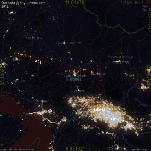
Quesada night lights from space
Night Light of Quesada (Alajuela) from space (Costa Rica) Src. Average luminocity for 10x10km area is 9.0124% and for 50x50km: 2.7291%.
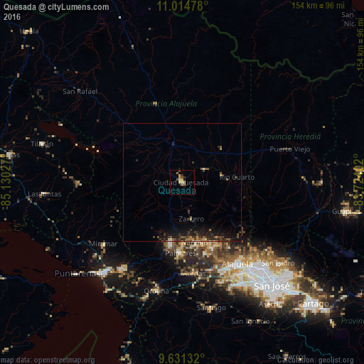
Analysis of Quesada night lights 2016
Square area 10x10 km:
 0%
0%90-99
0%80-89
2.48%70-79
2.48%60-69
1.24%50-59
2.07%40-49
2.48%30-39
0.21%20-29
1.45%10-19
0.83%0-9
86.78%Square area 50x50 km:
0.03%90-99
0.16%80-89
0.2%70-79
0.33%60-69
0.31%50-59
0.71%40-49
0.61%30-39
0.89%20-29
0.98%10-19
2.68%0-9
93.11%Clear (daylight) street map image can be seen on geolist.org.
Map coordinates:
11° 0' 53.2" North, 85° 7' 49" West
10° 19' 25.7" North, 84° 25' 37.7" West
9° 37' 52.8" North, 83° 43' 26.5" West
Some cities around Quesada sort by population:
• Alajuela
41.5 km =25.8 mi,  145°
145°
• Naranjo
25.6 km =15.9 mi,  167°
167°
• San Ramón
26.6 km =16.5 mi,  190°
190°
• Río Segundo
18.6 km =11.6 mi,  119°
119°
• San Juan
27.4 km =17 mi, 153°
• Atenas
39.2 km =24.4 mi, 172°
• Miramar
41.9 km =26 mi,  232°
232°
• Santo Domingo
41.5 km =25.8 mi,  134°
134°
3622190 (p: 27,310)
Sources (retrieved 2019-11-25):
» Earth at Night: Flat Maps 2012, 2016