Tilarán night lights from space
Night Light of Tilarán (Guanacaste) from space (Costa Rica) Src. Average luminocity for 10x10km area is 8.0971% and for 50x50km: 2.119%.
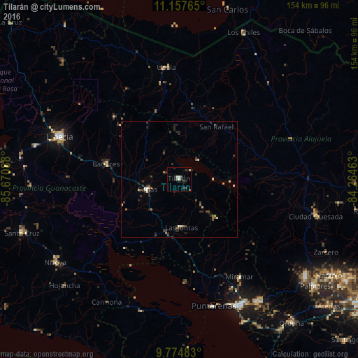
Analysis of Tilarán night lights 2016
Square area 10x10 km:
 0.83%
0.83%90-99
2.48%80-89
0%70-79
0%60-69
0.83%50-59
0.83%40-49
1.03%30-39
3.51%20-29
2.89%10-19
0.83%0-9
86.78%Square area 50x50 km:
0.12%90-99
0.41%80-89
0.13%70-79
0.08%60-69
0.35%50-59
0.23%40-49
0.3%30-39
0.94%20-29
0.85%10-19
0.42%0-9
96.16%Clear (daylight) street map image can be seen on geolist.org.
Map coordinates:
11° 9' 27.5" North, 85° 40' 15.2" West
10° 28' 1.2" North, 84° 58' 3.9" West
9° 46' 29.4" North, 84° 15' 52.7" West
Some cities around Tilarán sort by population:
• Liberia
54.7 km =34 mi,  289°
289°
• Puntarenas
56.4 km =35 mi,  165°
165°
• San José
56.9 km =35.4 mi,  341°
341°
• Quesada
61.2 km =38 mi,  105°
105°
• Chacarita
57.5 km =35.7 mi,  158°
158°
• Cañas
14.8 km =9.2 mi,  254°
254°
• Esparza
62.1 km =38.6 mi,  147°
147°
• Miramar
49.1 km =30.5 mi, 147°
3621278 (p: 7,301)
Sources (retrieved 2019-11-25):
» Earth at Night: Flat Maps 2012, 2016