Larreynaga night lights from space
Night Light of Larreynaga (León) from space (Nicaragua) Src. Average luminocity for 10x10km area is 0.2706% and for 50x50km: 0.2181%.
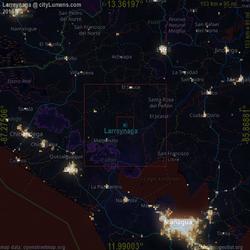
Analysis of Larreynaga night lights 2016
Square area 10x10 km:
 0%
0%90-99
0%80-89
0%70-79
0%60-69
0%50-59
0%40-49
0%30-39
0.22%20-29
0.65%10-19
0%0-9
99.13%Square area 50x50 km:
0%90-99
0.01%80-89
0.06%70-79
0.03%60-69
0.03%50-59
0.06%40-49
0.04%30-39
0.04%20-29
0.09%10-19
0.02%0-9
99.61%Clear (daylight) street map image can be seen on geolist.org.
Map coordinates:
13° 21' 43.1" North, 87° 16' 30.2" West
12° 40' 36.9" North, 86° 34' 18.9" West
11° 59' 24.1" North, 85° 52' 7.7" West
Some cities around Larreynaga sort by population:
• León
42.5 km =26.4 mi,  231°
231°
• Chichigalpa
50.6 km =31.4 mi,  257°
257°
• Nagarote
45.7 km =28.4 mi,  179°
179°
• La Paz Centro
39.1 km =24.3 mi,  196°
196°
• Ciudad Darío
49 km =30.4 mi,  82°
82°
• El Sauce
23.6 km =14.7 mi,  8°
8°
• Telica
35.6 km =22.1 mi,  241°
241°
• Posoltega
46.7 km =29 mi,  251°
251°
3618336 (p: 7,703)
Sources (retrieved 2019-11-25):
» Earth at Night: Flat Maps 2012, 2016