León night lights from space
Night Light of León from space (Nicaragua) Src. Average luminocity for 10x10km area is 38.4174% and for 50x50km: 3.0348%.
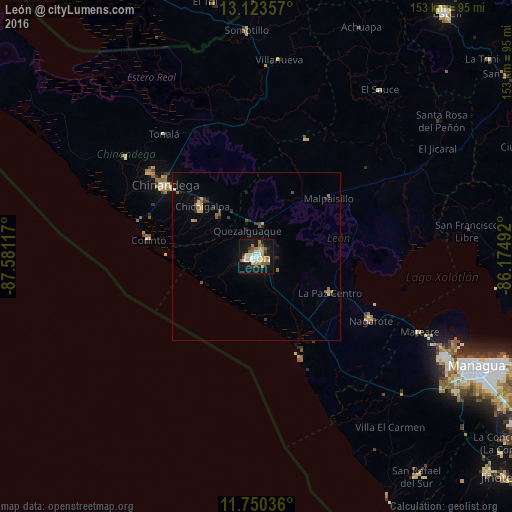
Analysis of León night lights 2016
Square area 10x10 km:
 2.48%
2.48%90-99
11.36%80-89
4.96%70-79
5.58%60-69
6.82%50-59
5.37%40-49
2.69%30-39
2.48%20-29
4.55%10-19
44.01%0-9
9.71%Square area 50x50 km:
0.1%90-99
0.51%80-89
0.36%70-79
0.42%60-69
0.51%50-59
0.4%40-49
0.34%30-39
0.36%20-29
0.61%10-19
2.58%0-9
93.8%Clear (daylight) street map image can be seen on geolist.org.
Map coordinates:
13° 7' 24.9" North, 87° 34' 52.2" West
12° 26' 16.3" North, 86° 52' 40.9" West
11° 45' 1.3" North, 86° 10' 29.7" West
Some cities around León sort by population:
• Chinandega
34.7 km =21.6 mi,  307°
307°
• Chichigalpa
22.4 km =13.9 mi, 313°
• Nagarote
39 km =24.2 mi,  119°
119°
• La Paz Centro
24.6 km =15.3 mi, 116°
• Corinto
32.4 km =20.1 mi,  278°
278°
• Telica
9.6 km =6 mi,  12°
12°
• Posoltega
16.2 km =10.1 mi,  316°
316°
• El Realejo
33.3 km =20.7 mi,  290°
290°
3618030 (p: 144,538)
Sources (retrieved 2019-11-25):
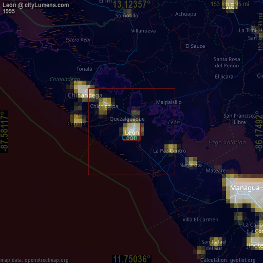
» NASA, Earths city lights 1995
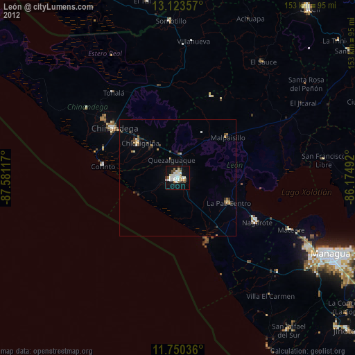
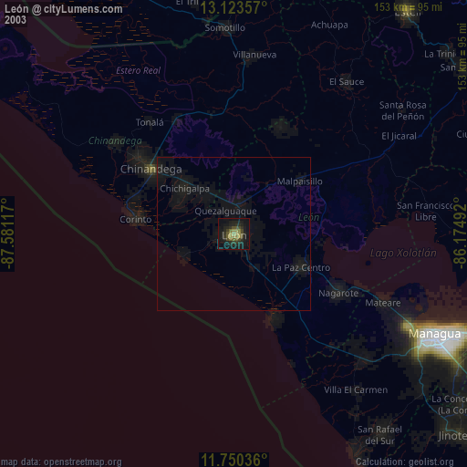
» NASA city lights 2003
» Earth at Night: Flat Maps 2012, 2016