Twon-Brass night lights from space
Night Light of Twon-Brass (Bayelsa) from space (Nigeria) Src. Average luminocity for 10x10km area is 5.0519% and for 50x50km: 7.3696%.
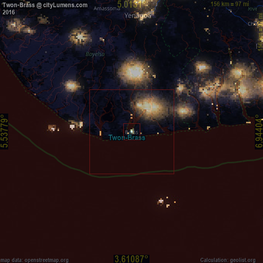
Analysis of Twon-Brass night lights 2016
Square area 10x10 km:
 0.22%
0.22%90-99
1.52%80-89
0.87%70-79
0%60-69
0%50-59
1.08%40-49
1.52%30-39
0.87%20-29
0.87%10-19
0%0-9
93.07%Square area 50x50 km:
0.08%90-99
0.78%80-89
1.61%70-79
0.84%60-69
0.86%50-59
1.15%40-49
1.93%30-39
2.51%20-29
2.61%10-19
4.4%0-9
83.23%Clear (daylight) street map image can be seen on geolist.org.
Map coordinates:
5° 0' 47.2" North, 5° 32' 16" East
4° 18' 44.3" North, 6° 14' 27.3" East
3° 36' 39.1" North, 6° 56' 38.5" East
Some cities around Twon-Brass sort by population:
• Port Harcourt
100 km =62.1 mi,  58°
58°
• Buguma
83.5 km =51.9 mi, 55°
• Obonoma
75.4 km =46.9 mi,  53°
53°
• Yenagoa
68.4 km =42.5 mi,  2°
2°
• Degema Hulk
75.3 km =46.8 mi, 48°
• Ahoada
96.9 km =60.2 mi,  27°
27°
• Bomadi
100.7 km =62.6 mi,  339°
339°
• Amassoma
74.6 km =46.4 mi,  348°
348°
2346734 (p: 11,122)
Sources (retrieved 2019-11-25):
» Earth at Night: Flat Maps 2012, 2016