Obonoma night lights from space
Night Light of Obonoma (Rivers) from space (Nigeria) Src. Average luminocity for 10x10km area is 6.5496% and for 50x50km: 23.8171%.
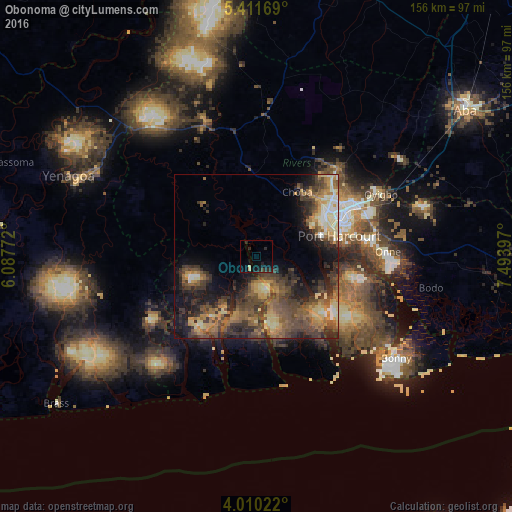
Analysis of Obonoma night lights 2016
Square area 10x10 km:
 0%
0%90-99
0%80-89
1.65%70-79
0%60-69
0%50-59
0%40-49
1.24%30-39
1.65%20-29
5.99%10-19
8.47%0-9
80.99%Square area 50x50 km:
1.07%90-99
2%80-89
3.77%70-79
3.46%60-69
4.71%50-59
5.24%40-49
7.15%30-39
6.95%20-29
6.82%10-19
9.95%0-9
48.89%Clear (daylight) street map image can be seen on geolist.org.
Map coordinates:
5° 24' 42.1" North, 6° 5' 15.8" East
4° 42' 40.7" North, 6° 47' 27" East
4° 0' 36.8" North, 7° 29' 38.3" East
Some cities around Obonoma sort by population:
• Port Harcourt
25.7 km =16 mi,  73°
73°
• Buguma
8.4 km =5.2 mi, 70°
• Okrika
32.6 km =20.3 mi,  83°
83°
• Yenagoa
62.7 km =39 mi,  292°
292°
• Elele
43.4 km =27 mi,  3°
3°
• Degema Hulk
7.2 km =4.5 mi,  320°
320°
• Bonny
51.1 km =31.8 mi,  124°
124°
• Ahoada
44.2 km =27.5 mi,  339°
339°
2328185 (p: 68,584)
Sources (retrieved 2019-11-25):
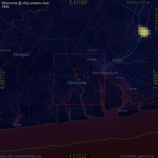
» NASA, Earths city lights 1995
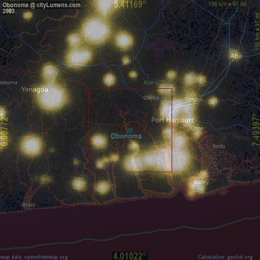
» NASA city lights 2003
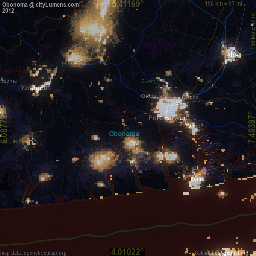
» Earth at Night: Flat Maps 2012, 2016