Potiskum night lights from space
Night Light of Potiskum (Yobe) from space (Nigeria) Src. Average luminocity for 10x10km area is 12.3864% and for 50x50km: 0.5247%.
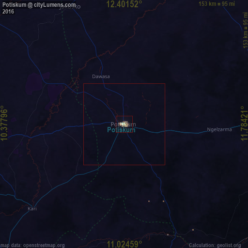
Analysis of Potiskum night lights 2016
Square area 10x10 km:
 0%
0%90-99
2.27%80-89
1.03%70-79
1.03%60-69
2.27%50-59
2.27%40-49
5.17%30-39
2.48%20-29
0.83%10-19
0.83%0-9
81.82%Square area 50x50 km:
0%90-99
0.09%80-89
0.04%70-79
0.04%60-69
0.09%50-59
0.09%40-49
0.21%30-39
0.1%20-29
0.03%10-19
0.03%0-9
99.26%Clear (daylight) street map image can be seen on geolist.org.
Map coordinates:
12° 24' 5.5" North, 10° 22' 40.7" East
11° 42' 50.1" North, 11° 4' 51.9" East
11° 1' 28.5" North, 11° 47' 3.2" East
Some cities around Potiskum sort by population:
• Daura
39.6 km =24.6 mi,  116°
116°
• Nafada
74 km =46 mi,  158°
158°
• Kari
76.8 km =47.7 mi,  227°
227°
• Gamawa
75.3 km =46.8 mi,  308°
308°
• Madara
69.3 km =43.1 mi,  276°
276°
• Sade
59.4 km =36.9 mi, 228°
• Lajere
49 km =30.4 mi,  52°
52°
• Yanda Bayo
43.1 km =26.8 mi,  237°
237°
2324767 (p: 86,002)
Sources (retrieved 2019-11-25):
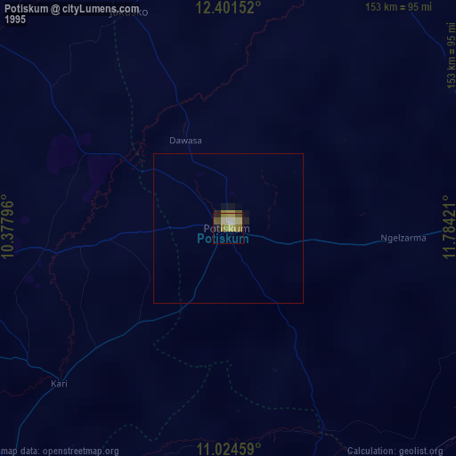
» NASA, Earths city lights 1995
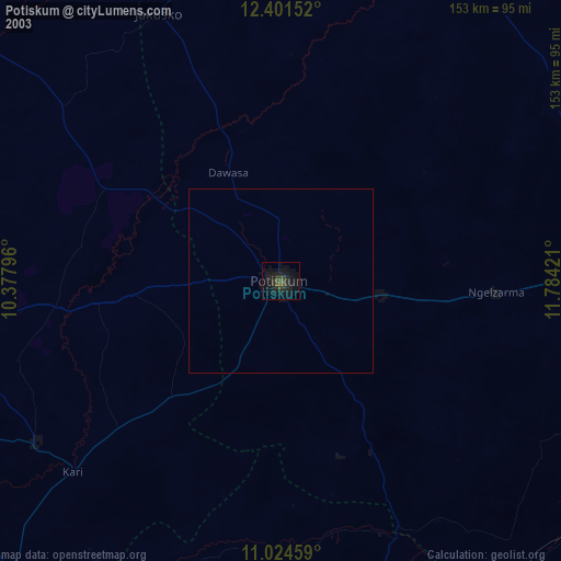
» NASA city lights 2003
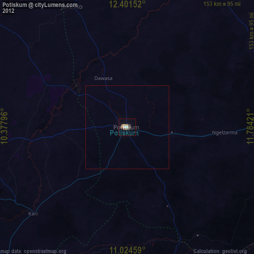
» Earth at Night: Flat Maps 2012, 2016