Kumo night lights from space
Night Light of Kumo (Gombe) from space (Nigeria) Src. Average luminocity for 10x10km area is 0% and for 50x50km: 0.6487%.
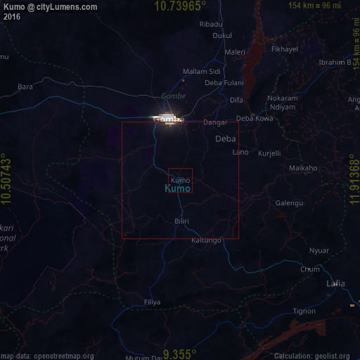
Analysis of Kumo night lights 2016
Square area 10x10 km:
100  0%
0%
90-99 0%
80-89 0%
70-79 0%
60-69 0%
50-59 0%
40-49 0%
30-39 0%
20-29 0%
10-19 0%
0-9 100%
0%90-99
0%80-89
0%70-79
0%60-69
0%50-59
0%40-49
0%30-39
0%20-29
0%10-19
0%0-9
100%Square area 50x50 km:
100 0.07%
90-99 0.13%
80-89 0.08%
70-79 0.02%
60-69 0.03%
50-59 0.02%
40-49 0.04%
30-39 0.01%
20-29 0.16%
10-19 1.22%
0-9 98.23%
0.07%90-99
0.13%80-89
0.08%70-79
0.02%60-69
0.03%50-59
0.02%40-49
0.04%30-39
0.01%20-29
0.16%10-19
1.22%0-9
98.23%Clear (daylight) street map image can be seen on geolist.org.
Map coordinates:
10° 44' 22.7" North, 10° 30' 26.7" East
10° 2' 53.1" North, 11° 12' 38" East
9° 21' 18" North, 11° 54' 49.2" East
Some cities around Kumo sort by population:
• Gombe
27.3 km =17 mi,  350°
350°
• Pindiga
29.2 km =18.1 mi,  255°
255°
• Garko
15 km =9.3 mi,  340°
340°
• Deba
26.6 km =16.5 mi,  46°
46°
• Billiri
20.4 km =12.7 mi,  175°
175°
• Kaltungo
27.5 km =17.1 mi,  157°
157°
• Kafarati
39.3 km =24.4 mi, 341°
• Akko
37.3 km =23.2 mi,  315°
315°
2333451 (p: 35,712)
Sources (retrieved 2019-11-25):
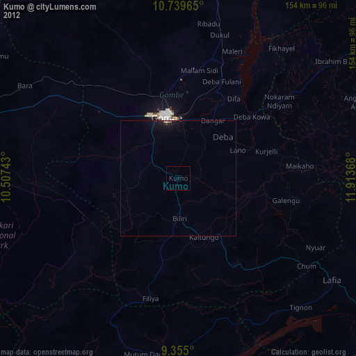
» Earth at Night: Flat Maps 2012, 2016