Garko night lights from space
Night Light of Garko (Gombe) from space (Nigeria) Src. Average luminocity for 10x10km area is 0.2521% and for 50x50km: 2.129%.
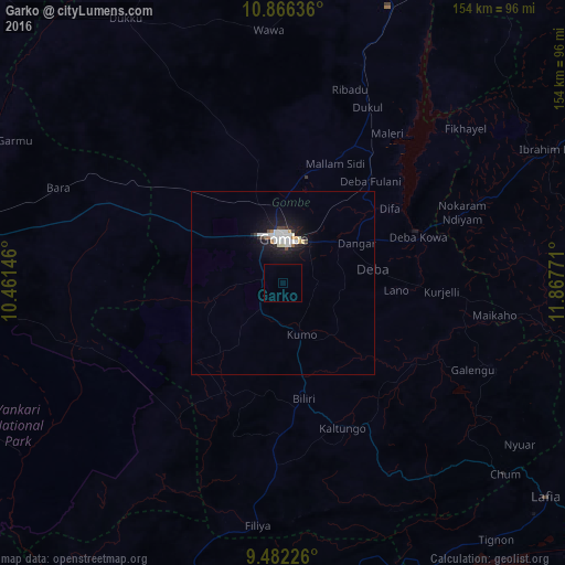
Analysis of Garko night lights 2016
Square area 10x10 km:
100  0%
0%
90-99 0%
80-89 0%
70-79 0%
60-69 0%
50-59 0%
40-49 0%
30-39 0%
20-29 0%
10-19 0%
0-9 100%
0%90-99
0%80-89
0%70-79
0%60-69
0%50-59
0%40-49
0%30-39
0%20-29
0%10-19
0%0-9
100%Square area 50x50 km:
100 0.48%
90-99 0.57%
80-89 0.09%
70-79 0.1%
60-69 0.15%
50-59 0.08%
40-49 0.12%
30-39 0.13%
20-29 0.29%
10-19 2.68%
0-9 95.3%
0.48%90-99
0.57%80-89
0.09%70-79
0.1%60-69
0.15%50-59
0.08%40-49
0.12%30-39
0.13%20-29
0.29%10-19
2.68%0-9
95.3%Clear (daylight) street map image can be seen on geolist.org.
Map coordinates:
10° 51' 58.9" North, 10° 27' 41.3" East
10° 10' 30.2" North, 11° 9' 52.5" East
9° 28' 56.1" North, 11° 52' 3.8" East
Some cities around Garko sort by population:
• Gombe
12.7 km =7.9 mi,  1°
1°
• Pindiga
31.5 km =19.6 mi,  227°
227°
• Kumo
15 km =9.3 mi,  160°
160°
• Deba
24.7 km =15.3 mi,  80°
80°
• Billiri
35.1 km =21.8 mi,  168°
168°
• Kafarati
24.3 km =15.1 mi,  341°
341°
• Hinna
39.3 km =24.4 mi,  68°
68°
• Akko
24.5 km =15.2 mi,  301°
301°
2341758 (p: 21,141)
Sources (retrieved 2019-11-25):
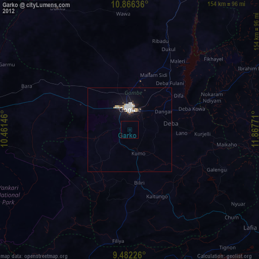
» Earth at Night: Flat Maps 2012, 2016