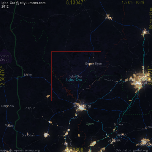
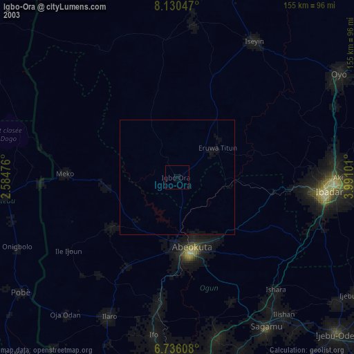
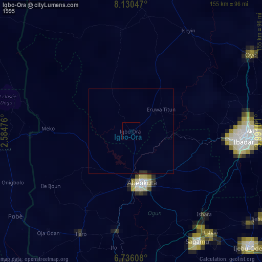
Igbo-Ora night lights from space
Night Light of Igbo-Ora (Oyo) from space (Nigeria) Src. Average luminocity for 10x10km area is 0% and for 50x50km: 0.0144%.
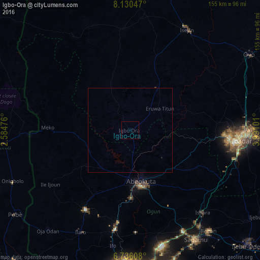
Analysis of Igbo-Ora night lights 2016
Square area 10x10 km:
 0%
0%90-99
0%80-89
0%70-79
0%60-69
0%50-59
0%40-49
0%30-39
0%20-29
0%10-19
0%0-9
100%Square area 50x50 km:
0%90-99
0%80-89
0%70-79
0%60-69
0%50-59
0%40-49
0%30-39
0.02%20-29
0.03%10-19
0%0-9
99.95%Clear (daylight) street map image can be seen on geolist.org.
Map coordinates:
8° 7' 49.7" North, 2° 35' 5.1" East
7° 26' 1.8" North, 3° 17' 16.4" East
6° 44' 9.9" North, 3° 59' 27.6" East
Some cities around Igbo-Ora sort by population:
• Ibadan
68.4 km =42.5 mi,  95°
95°
• Abeokuta
31.6 km =19.6 mi,  168°
168°
• Orita Eruwa
20.6 km =12.8 mi,  51°
51°
• Ilaro
67.7 km =42.1 mi,  206°
206°
• Okeho
67 km =41.6 mi,  5°
5°
• Imeko
49.1 km =30.5 mi,  271°
271°
• Owode
59.1 km =36.7 mi,  156°
156°
• Isara
65.4 km =40.6 mi,  138°
138°
2338669 (p: 92,719)
Sources (retrieved 2019-11-25):
» NASA, Earths city lights 1995
» NASA city lights 2003
» Earth at Night: Flat Maps 2012, 2016