Isara night lights from space
Night Light of Isara (Ogun) from space (Nigeria) Src. Average luminocity for 10x10km area is 3.7662% and for 50x50km: 4.7419%.
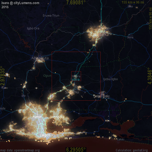
Analysis of Isara night lights 2016
Square area 10x10 km:
 0%
0%90-99
0%80-89
0%70-79
0%60-69
0%50-59
0%40-49
0.43%30-39
5.84%20-29
2.38%10-19
2.16%0-9
89.18%Square area 50x50 km:
0.11%90-99
0.24%80-89
0.23%70-79
0.46%60-69
0.55%50-59
1.09%40-49
1.4%30-39
1.84%20-29
1.82%10-19
4.58%0-9
87.67%Clear (daylight) street map image can be seen on geolist.org.
Map coordinates:
7° 41' 26.9" North, 2° 58' 42.1" East
6° 59' 36.4" North, 3° 40' 53.3" East
6° 17' 42.2" North, 4° 23' 4.6" East
Some cities around Isara sort by population:
• Abeokuta
41.3 km =25.7 mi,  295°
295°
• Shagamu
16.6 km =10.3 mi,  193°
193°
• Ijebu-Ode
32.4 km =20.1 mi,  126°
126°
• Ijebu-Igbo
35.2 km =21.9 mi,  93°
93°
• Iperu
9.4 km =5.8 mi, 190°
• Ejirin
48.6 km =30.2 mi,  150°
150°
• Owode
20 km =12.4 mi,  255°
255°
• Ijebu-Ife
45.7 km =28.4 mi,  121°
121°
2337227 (p: 8,205)
Sources (retrieved 2019-11-25):
» Earth at Night: Flat Maps 2012, 2016