Ifo night lights from space
Night Light of Ifo (Ogun) from space (Nigeria) Src. Average luminocity for 10x10km area is 1.5173% and for 50x50km: 16.7613%.
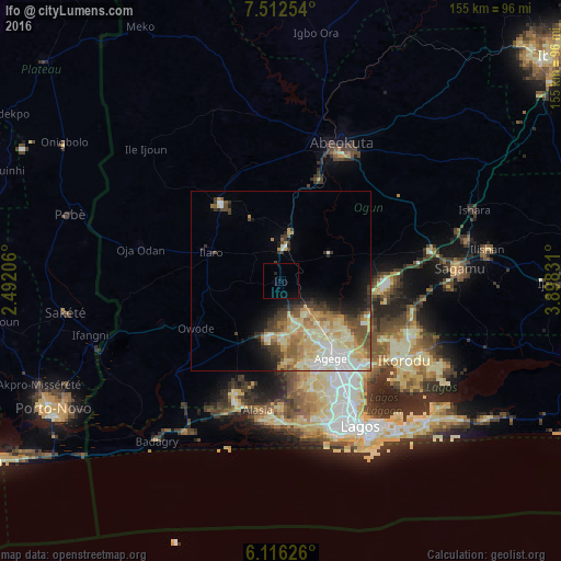
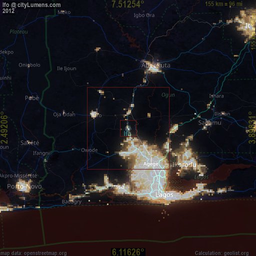
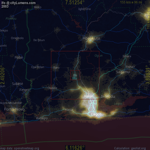
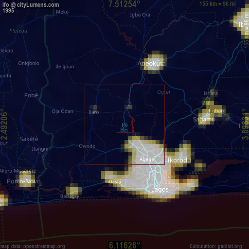
Analysis of Ifo night lights 2016
Square area 10x10 km:
 0%
0%90-99
0%80-89
0%70-79
0%60-69
0%50-59
0%40-49
0%30-39
0.43%20-29
0.87%10-19
1.52%0-9
97.19%Square area 50x50 km:
1.99%90-99
3.46%80-89
3.96%70-79
2.91%60-69
2.35%50-59
2.02%40-49
2.15%30-39
2.05%20-29
2.05%10-19
4.23%0-9
72.83%Clear (daylight) street map image can be seen on geolist.org.
Map coordinates:
7° 30' 45.1" North, 2° 29' 31.4" East
6° 48' 53.7" North, 3° 11' 42.6" East
6° 6' 58.5" North, 3° 53' 53.9" East
Some cities around Ifo sort by population:
• Lagos
45.8 km =28.5 mi,  151°
151°
• Abeokuta
41.3 km =25.7 mi,  23°
23°
• Ebute Ikorodu
40.2 km =25 mi,  126°
126°
• Ikeja
29.2 km =18.1 mi, 146°
• Makoko
41.3 km =25.7 mi, 149°
• Ilaro
21.6 km =13.4 mi,  292°
292°
• Ado-Odo
37.1 km =23.1 mi,  228°
228°
• Owode
37.3 km =23.2 mi,  66°
66°
2338876 (p: 88,272)
Sources (retrieved 2019-11-25):
» NASA, Earths city lights 1995
» NASA city lights 2003
» Earth at Night: Flat Maps 2012, 2016