Ikeja night lights from space
Night Light of Ikeja (Lagos) from space (Nigeria) Src. Average luminocity for 10x10km area is 97.0455% and for 50x50km: 51.5088%.
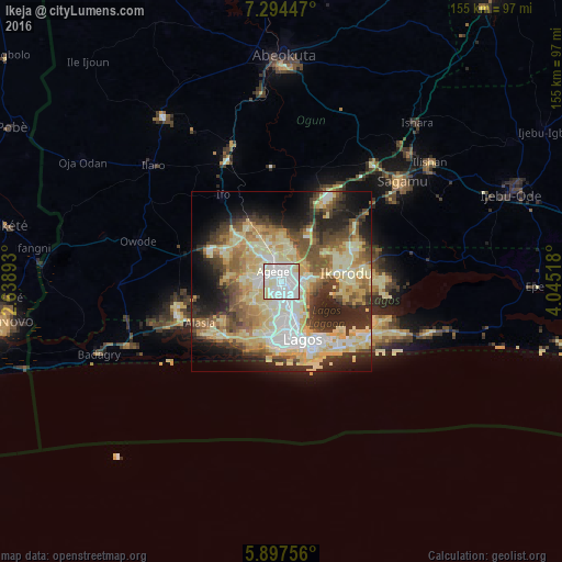

Analysis of Ikeja night lights 2016
Square area 10x10 km:
 50.87%
90-99
37.66%80-89
10.82%70-79
0.65%60-69
0%50-59
0%40-49
0%30-39
0%20-29
0%10-19
0%0-9
0%Square area 50x50 km:
6.69%90-99
11.22%80-89
12.96%70-79
8.07%60-69
5.83%50-59
6.33%40-49
6.67%30-39
6.94%20-29
10.42%10-19
10.44%0-9
14.43%Clear (daylight) street map image can be seen on geolist.org.
Map coordinates:
7° 17' 40.1" North, 2° 38' 20.1" East
6° 35' 47.4" North, 3° 20' 31.4" East
5° 53' 51.2" North, 4° 2' 42.6" East
Some cities around Ikeja sort by population:
• Lagos
16.9 km =10.5 mi,  159°
159°
• Ebute Ikorodu
16.1 km =10 mi,  88°
88°
• Shagamu
43.7 km =27.2 mi,  50°
50°
• Ifo
29.2 km =18.1 mi,  326°
326°
• Makoko
12.3 km =7.6 mi, 155°
• Ilaro
48.7 km =30.3 mi,  311°
311°
• Ado-Odo
44.2 km =27.5 mi,  269°
269°
• Owode
43.1 km =26.8 mi,  24°
24°
2338313 (p: 313,196)
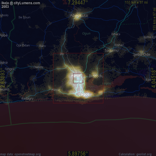
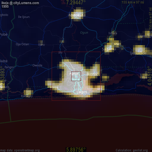
Sources (retrieved 2019-11-25):
» NASA, Earths city lights 1995
» NASA city lights 2003
» Earth at Night: Flat Maps 2012, 2016