Lagos night lights from space
Night Light of Lagos from space (Nigeria) Src. Average luminocity for 10x10km area is 88.8485% and for 50x50km: 43.4949%.
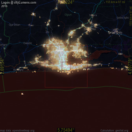
Analysis of Lagos night lights 2016
Square area 10x10 km:
 40.48%
90-99
27.06%80-89
10.39%70-79
11.04%60-69
0%50-59
1.08%40-49
4.76%30-39
4.98%20-29
0.22%10-19
0%0-9
0%Square area 50x50 km:
6.44%90-99
10.13%80-89
12.11%70-79
6.78%60-69
4.58%50-59
4.72%40-49
4.13%30-39
4.42%20-29
8.08%10-19
6.14%0-9
32.46%Clear (daylight) street map image can be seen on geolist.org.
Map coordinates:
7° 9' 8.1" North, 2° 41' 29.5" East
6° 27' 14.7" North, 3° 23' 40.8" East
5° 45' 17.8" North, 4° 5' 52" East
Some cities around Lagos sort by population:
• Ebute Ikorodu
19.3 km =12 mi,  32°
32°
• Ikeja
16.9 km =10.5 mi,  339°
339°
• Shagamu
51.9 km =32.2 mi, 32°
• Ifo
45.8 km =28.5 mi,  331°
331°
• Makoko
4.7 km =2.9 mi,  350°
350°
• Badagry
56.9 km =35.4 mi,  265°
265°
• Ado-Odo
52.4 km =32.6 mi,  287°
287°
• Owode
56.3 km =35 mi,  12°
12°
2332459 (p: 9,000,000)
Sources (retrieved 2019-11-25):
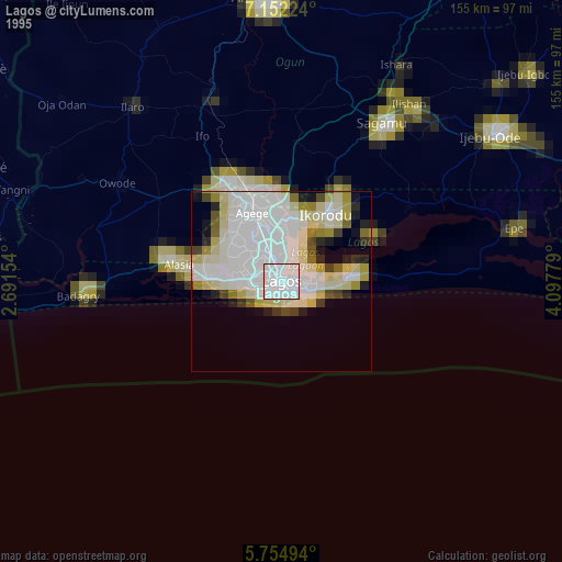
» NASA, Earths city lights 1995
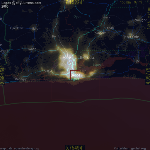
» NASA city lights 2003
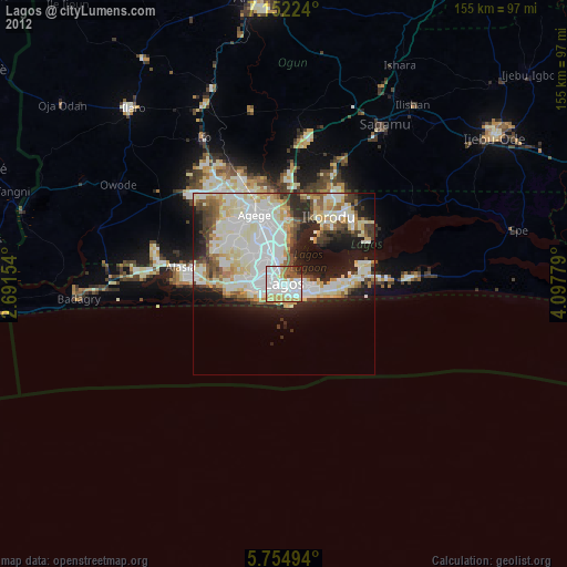
» Earth at Night: Flat Maps 2012, 2016