Benin City night lights from space
Night Light of Benin City (Edo) from space (Nigeria) Src. Average luminocity for 10x10km area is 67.6732% and for 50x50km: 6.2992%.
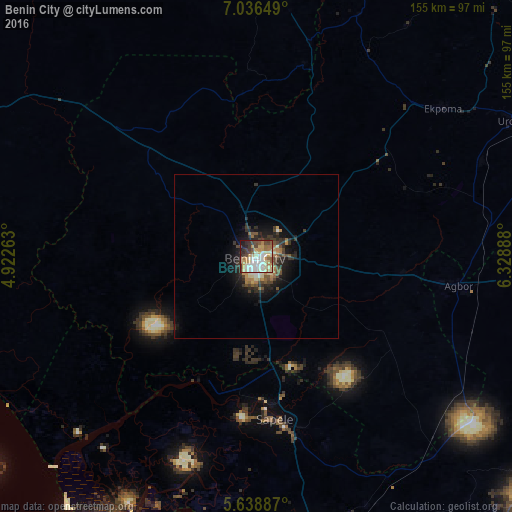
Analysis of Benin City night lights 2016
Square area 10x10 km:
 10.82%
90-99
20.56%80-89
12.12%70-79
11.04%60-69
9.09%50-59
5.63%40-49
7.79%30-39
11.9%20-29
6.71%10-19
4.11%0-9
0.22%Square area 50x50 km:
0.46%90-99
1.09%80-89
0.75%70-79
0.83%60-69
0.98%50-59
0.74%40-49
1.24%30-39
1.5%20-29
1.89%10-19
4%0-9
86.53%Clear (daylight) street map image can be seen on geolist.org.
Map coordinates:
7° 2' 11.4" North, 4° 55' 21.5" East
6° 20' 17.3" North, 5° 37' 32.7" East
5° 38' 19.9" North, 6° 19' 44" East
Some cities around Benin City sort by population:
• Sapele
49.7 km =30.9 mi,  173°
173°
• Agbor
63.5 km =39.5 mi,  98°
98°
• Ekpoma
72.5 km =45 mi,  51°
51°
• Obiaruku
79.9 km =49.6 mi,  133°
133°
• Umunede
76 km =47.2 mi, 96°
• Siluko
56 km =34.8 mi,  293°
293°
• Ifon
67.8 km =42.1 mi,  13°
13°
• Abraka
80.7 km =50.1 mi,  139°
139°
2347283 (p: 1,125,058)
Sources (retrieved 2019-11-25):
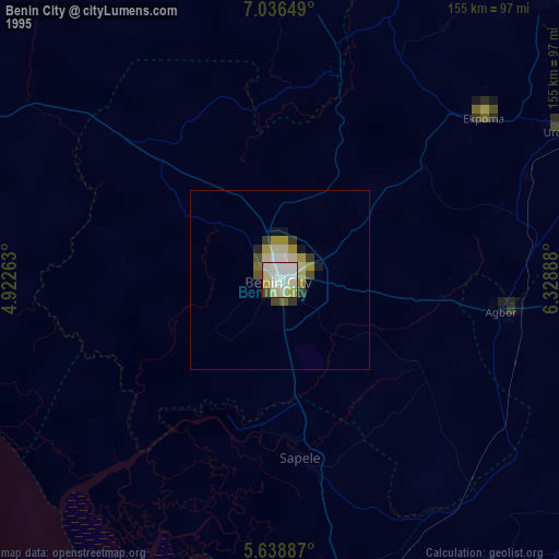
» NASA, Earths city lights 1995
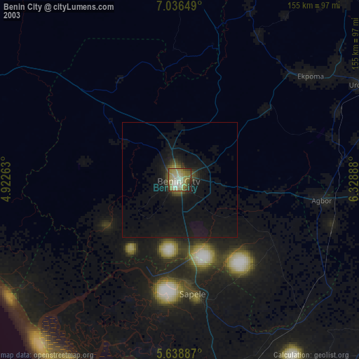
» NASA city lights 2003
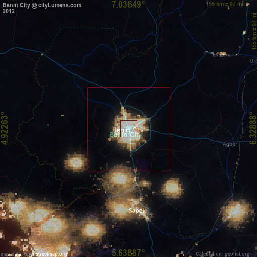
» Earth at Night: Flat Maps 2012, 2016