Kuala Terengganu night lights from space
Night Light of Kuala Terengganu (Terengganu) from space (Malaysia) Src. Average luminocity for 10x10km area is 65.2603% and for 50x50km: 14.5194%.
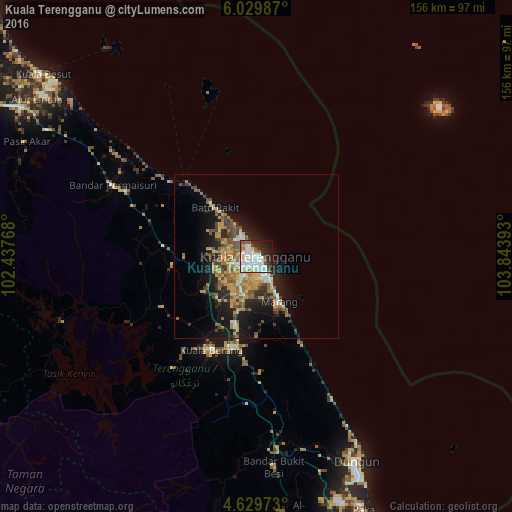
Analysis of Kuala Terengganu night lights 2016
Square area 10x10 km:
 21.49%
90-99
24.17%80-89
4.13%70-79
3.93%60-69
1.65%50-59
6.2%40-49
5.58%30-39
3.72%20-29
16.12%10-19
10.33%0-9
2.69%Square area 50x50 km:
1.56%90-99
1.71%80-89
1.62%70-79
3.29%60-69
2.16%50-59
2.64%40-49
2.17%30-39
2.01%20-29
3.66%10-19
9.42%0-9
69.74%Clear (daylight) street map image can be seen on geolist.org.
Map coordinates:
6° 1' 47.5" North, 102° 26' 15.6" East
5° 19' 48.7" North, 103° 8' 26.9" East
4° 37' 47" North, 103° 50' 38.1" East
Some cities around Kuala Terengganu sort by population:
• Kampong Pangkal Kalong
121.3 km =75.4 mi,  302°
302°
• Tanah Merah
121.5 km =75.5 mi, 295°
• Kertih
96.9 km =60.2 mi,  159°
159°
• Peringat
122.9 km =76.4 mi,  309°
309°
• Marang
15.6 km =9.7 mi,  152°
152°
• Paka
83.7 km =52 mi, 156°
• Kampong Kadok
123.5 km =76.7 mi, 307°
• Jertih
84.9 km =52.8 mi, 301°
1734705 (p: 285,065)
Sources (retrieved 2019-11-25):
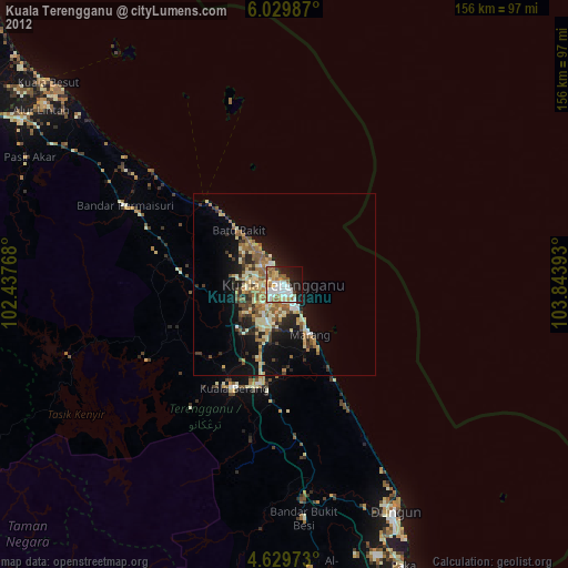
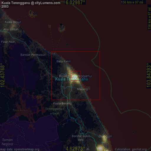
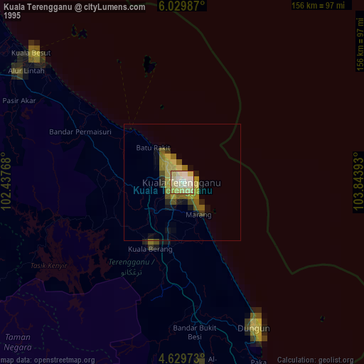
» NASA, Earths city lights 1995
» NASA city lights 2003
» Earth at Night: Flat Maps 2012, 2016