Kampung Simpang Renggam night lights from space
Night Light of Kampung Simpang Renggam (Johor) from space (Malaysia) Src. Average luminocity for 10x10km area is 31.3377% and for 50x50km: 13.7267%.
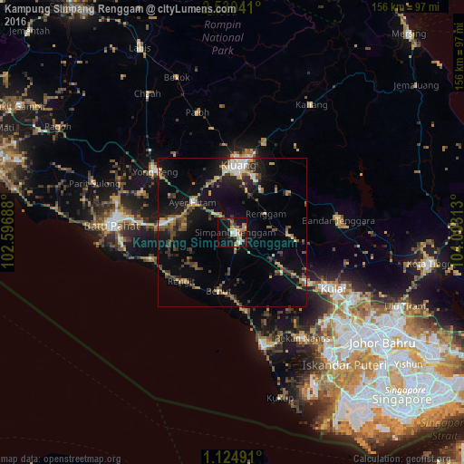
Analysis of Kampung Simpang Renggam night lights 2016
Square area 10x10 km:
 3.68%
3.68%90-99
4.76%80-89
2.81%70-79
8.66%60-69
4.33%50-59
3.46%40-49
3.25%30-39
1.52%20-29
3.68%10-19
37.23%0-9
26.62%Square area 50x50 km:
1.08%90-99
1.33%80-89
0.8%70-79
2.72%60-69
1.74%50-59
2.09%40-49
2.73%30-39
2.03%20-29
3.44%10-19
11.1%0-9
70.93%Clear (daylight) street map image can be seen on geolist.org.
Map coordinates:
2° 31' 49.5" North, 102° 35' 48.8" East
1° 49' 40.1" North, 103° 18' 0" East
1° 7' 29.7" North, 104° 0' 11.3" East
Some cities around Kampung Simpang Renggam sort by population:
• Kluang
22.6 km =14 mi,  4°
4°
• Batu Pahat
41 km =25.5 mi,  274°
274°
• Kulai
38.7 km =24 mi,  119°
119°
• Pontian Kechil
39.2 km =24.4 mi,  165°
165°
• Yong Peng
33.2 km =20.6 mi,  308°
308°
• Pekan Nenas
42.6 km =26.5 mi,  146°
146°
• Parit Raja
21.3 km =13.2 mi,  282°
282°
• Kelapa Sawit
31.3 km =19.4 mi, 124°
1764318 (p: 17,528)
Sources (retrieved 2019-11-25):
» Earth at Night: Flat Maps 2012, 2016