Sungai Petani night lights from space
Night Light of Sungai Petani (Kedah) from space (Malaysia) Src. Average luminocity for 10x10km area is 82.6839% and for 50x50km: 26.2073%.
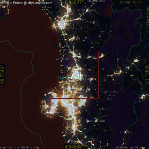
Analysis of Sungai Petani night lights 2016
Square area 10x10 km:
 40.29%
90-99
23.97%80-89
4.34%70-79
6.2%60-69
4.75%50-59
3.1%40-49
3.1%30-39
9.3%20-29
4.96%10-19
0%0-9
0%Square area 50x50 km:
4.95%90-99
4.49%80-89
2.45%70-79
2.66%60-69
3.53%50-59
3.84%40-49
5.03%30-39
5.64%20-29
6.85%10-19
11.29%0-9
49.26%Clear (daylight) street map image can be seen on geolist.org.
Map coordinates:
6° 20' 46.6" North, 99° 47' 4.6" East
5° 38' 49.2" North, 100° 29' 15.8" East
4° 56' 48.8" North, 101° 11' 27.1" East
Some cities around Sungai Petani sort by population:
• George Town
31.2 km =19.4 mi,  212°
212°
• Tasek Glugor
18.6 km =11.6 mi,  176°
176°
• Butterworth
30.8 km =19.1 mi, 206°
• Bedong
9.2 km =5.7 mi,  14°
14°
• Permatang Kuching
23.6 km =14.7 mi, 209°
• Tanjung Tokong
28.8 km =17.9 mi,  223°
223°
• Kepala Batas
16 km =9.9 mi, 205°
• Gurun
19 km =11.8 mi,  355°
355°
1735498 (p: 228,843)
Sources (retrieved 2019-11-25):
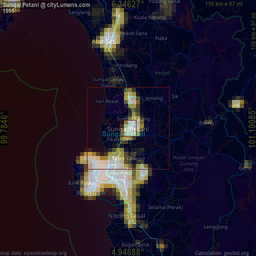
» NASA, Earths city lights 1995
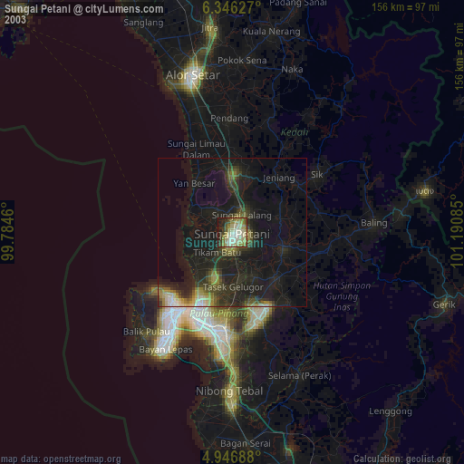
» NASA city lights 2003
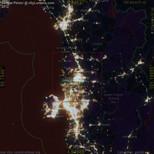
» Earth at Night: Flat Maps 2012, 2016