Tasek Glugor night lights from space
Night Light of Tasek Glugor (Penang) from space (Malaysia) Src. Average luminocity for 10x10km area is 61.4174% and for 50x50km: 38.7039%.
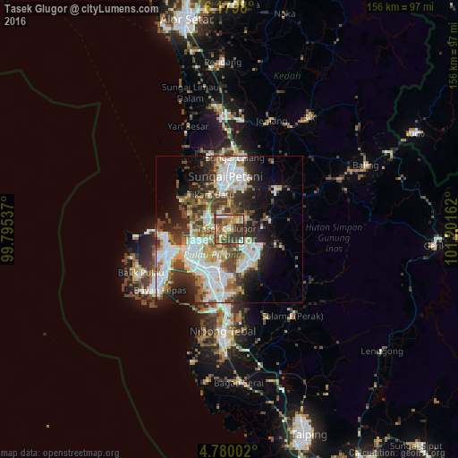
Analysis of Tasek Glugor night lights 2016
Square area 10x10 km:
 7.44%
7.44%90-99
10.12%80-89
6.61%70-79
10.54%60-69
17.15%50-59
11.98%40-49
13.22%30-39
20.45%20-29
2.48%10-19
0%0-9
0%Square area 50x50 km:
10.46%90-99
8.63%80-89
3.13%70-79
3.82%60-69
4.4%50-59
4.69%40-49
6.1%30-39
6.52%20-29
7.94%10-19
9.73%0-9
34.59%Clear (daylight) street map image can be seen on geolist.org.
Map coordinates:
6° 10' 47.3" North, 99° 47' 43.3" East
5° 28' 49.2" North, 100° 29' 54.6" East
4° 46' 48.1" North, 101° 12' 5.8" East
Some cities around Tasek Glugor sort by population:
• George Town
19.6 km =12.2 mi,  246°
246°
• Sungai Petani
18.6 km =11.6 mi,  356°
356°
• Bukit Mertajam
13.5 km =8.4 mi,  195°
195°
• Kulim
14.6 km =9.1 mi,  151°
151°
• Butterworth
17.4 km =10.8 mi,  238°
238°
• Perai
16.7 km =10.4 mi,  229°
229°
• Permatang Kuching
13.1 km =8.1 mi,  261°
261°
• Kepala Batas
9 km =5.6 mi,  297°
297°
1735093 (p: 135,786)
Sources (retrieved 2019-11-25):
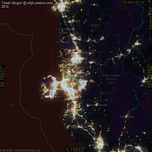
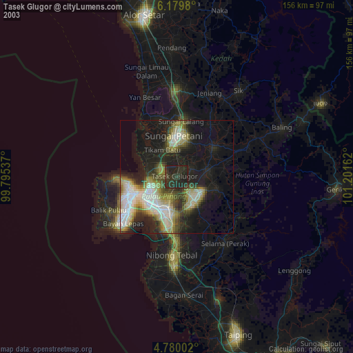
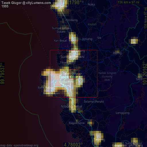
» NASA, Earths city lights 1995
» NASA city lights 2003
» Earth at Night: Flat Maps 2012, 2016