Zumpango night lights from space
Night Light of Zumpango (México) from space (Mexico) Src. Average luminocity for 10x10km area is 74.2252% and for 50x50km: 61.8901%.
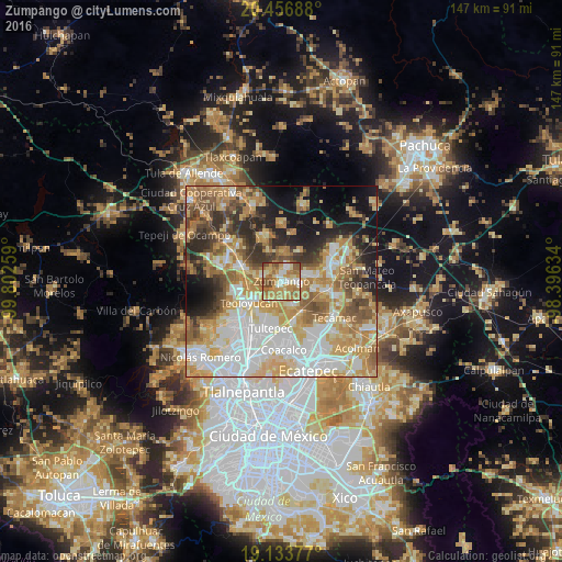
Analysis of Zumpango night lights 2016
Square area 10x10 km:
 8.88%
8.88%90-99
12.4%80-89
14.05%70-79
23.14%60-69
22.93%50-59
13.02%40-49
4.34%30-39
1.24%20-29
0%10-19
0%0-9
0%Square area 50x50 km:
14.3%90-99
11.4%80-89
10.96%70-79
11.7%60-69
10.47%50-59
6.97%40-49
6.17%30-39
5.21%20-29
7.55%10-19
9.36%0-9
5.92%Clear (daylight) street map image can be seen on geolist.org.
Map coordinates:
20° 27' 24.8" North, 99° 48' 9.3" West
19° 47' 48.1" North, 99° 5' 58.1" West
19° 8' 1.6" North, 98° 23' 46.8" West
Some cities around Zumpango sort by population:
• San Juan Zitlaltepec
5.1 km =3.2 mi,  289°
289°
• Santa Ana Nextlalpan
6.6 km =4.1 mi,  157°
157°
• Jaltenco
4.9 km =3 mi,  173°
173°
• Fraccionamiento la Trinidad
4 km =2.5 mi,  25°
25°
• Paseos de San Juan
8.7 km =5.4 mi,  100°
100°
• San Sebastián
4.8 km =3 mi,  106°
106°
• Miguel Bocanegra
5.6 km =3.5 mi,  346°
346°
• Arbolada los Sauces
6.2 km =3.9 mi,  69°
69°
3513966 (p: 50,742)
Sources (retrieved 2019-11-25):
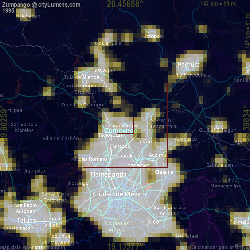
» NASA, Earths city lights 1995
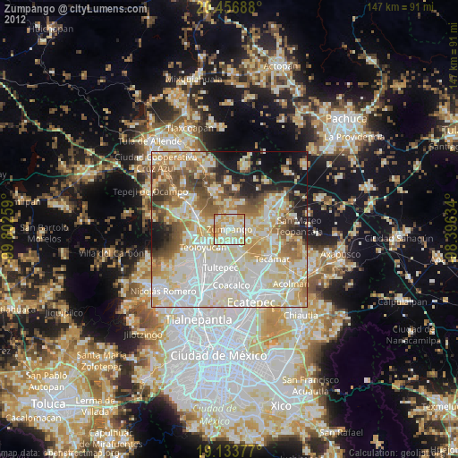
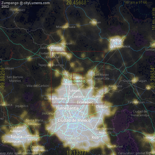
» NASA city lights 2003
» Earth at Night: Flat Maps 2012, 2016