Zacatelco night lights from space
Night Light of Zacatelco (Tlaxcala) from space (Mexico) Src. Average luminocity for 10x10km area is 78.355% and for 50x50km: 54.9377%.
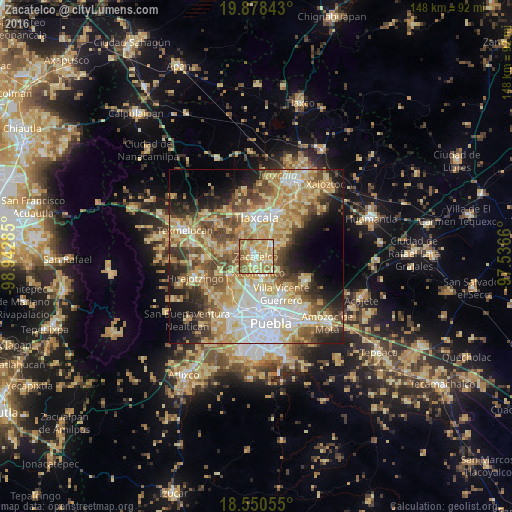
Analysis of Zacatelco night lights 2016
Square area 10x10 km:
 4.76%
4.76%90-99
12.77%80-89
32.47%70-79
25.32%60-69
12.99%50-59
10.39%40-49
1.3%30-39
0%20-29
0%10-19
0%0-9
0%Square area 50x50 km:
9.25%90-99
7.67%80-89
14.93%70-79
10.36%60-69
7.85%50-59
7.37%40-49
8.15%30-39
5.38%20-29
6.43%10-19
9.09%0-9
13.52%Clear (daylight) street map image can be seen on geolist.org.
Map coordinates:
19° 52' 42.3" North, 98° 56' 34.3" West
19° 12' 57" North, 98° 14' 23" West
18° 33' 2" North, 97° 32' 11.8" West
Some cities around Zacatelco sort by population:
• Papalotla
6.5 km =4 mi,  144°
144°
• Teolocholco
6 km =3.7 mi,  59°
59°
• Acuitlapilco
6.4 km =4 mi,  4°
4°
• Xicohtzinco
4.7 km =2.9 mi,  172°
172°
• Mazatecochco
6.9 km =4.3 mi,  126°
126°
• Santa Catarina Ayometla
3.4 km =2.1 mi, 125°
• San Juan Huactzinco
2.4 km =1.5 mi,  325°
325°
• San Lorenzo Axocomanitla
1.3 km =0.8 mi,  313°
313°
3815392 (p: 38,466)
Sources (retrieved 2019-11-25):
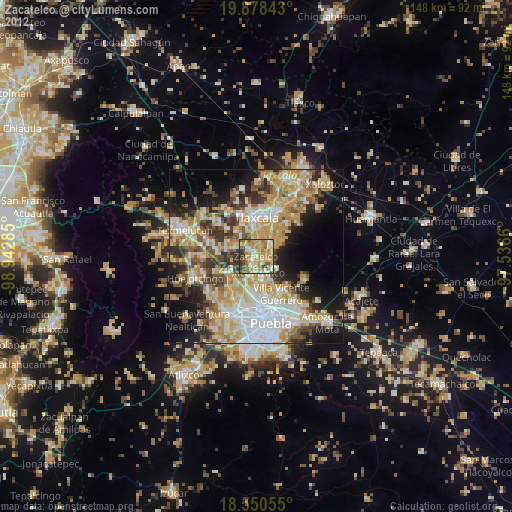
» Earth at Night: Flat Maps 2012, 2016