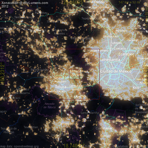
Xonacatlán night lights from space
Night Light of Xonacatlán (México) from space (Mexico) Src. Average luminocity for 10x10km area is 65.7851% and for 50x50km: 48.7786%.
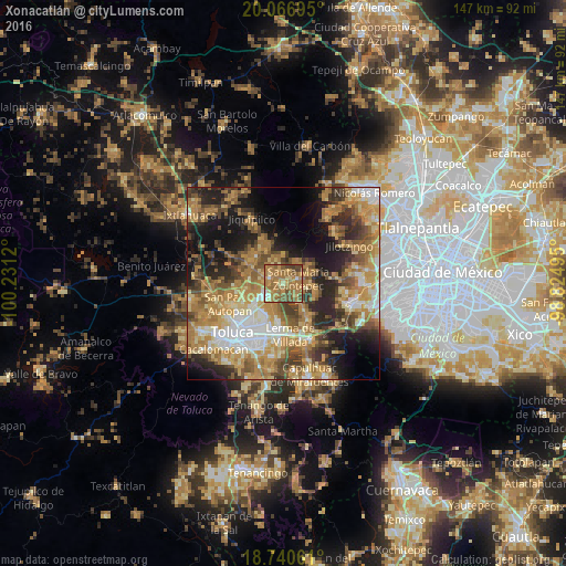
Analysis of Xonacatlán night lights 2016
Square area 10x10 km:
 2.07%
2.07%90-99
3.1%80-89
8.88%70-79
18.39%60-69
41.53%50-59
13.22%40-49
10.95%30-39
1.86%20-29
0%10-19
0%0-9
0%Square area 50x50 km:
5.73%90-99
5.63%80-89
8.19%70-79
10.9%60-69
13.45%50-59
6.81%40-49
7.83%30-39
6.2%20-29
9.45%10-19
12.81%0-9
13.01%Clear (daylight) street map image can be seen on geolist.org.
Map coordinates:
20° 4' 1" North, 100° 13' 52.3" West
19° 24' 18.5" North, 99° 31' 41.1" West
18° 44' 26.2" North, 98° 49' 29.8" West
Some cities around Xonacatlán sort by population:
• Villa Cuauhtémoc
3.5 km =2.2 mi,  291°
291°
• Santa María Zolotepec
3.9 km =2.4 mi,  69°
69°
• El Cerrillo Vista Hermosa
9.2 km =5.7 mi,  189°
189°
• San Nicolás Tolentino
6.9 km =4.3 mi,  221°
221°
• Santa Ana Jilotzingo
7 km =4.3 mi,  36°
36°
• La Constitución Toltepec
6.7 km =4.2 mi,  199°
199°
• San Lorenzo Oyamel
6.1 km =3.8 mi,  301°
301°
• San Pedro Abajo
9.4 km =5.8 mi,  334°
334°
3514409 (p: 20,680)
Sources (retrieved 2019-11-25):
» Earth at Night: Flat Maps 2012, 2016