Villa Unión night lights from space
Night Light of Villa Unión (Sinaloa) from space (Mexico) Src. Average luminocity for 10x10km area is 15.2102% and for 50x50km: 7.775%.
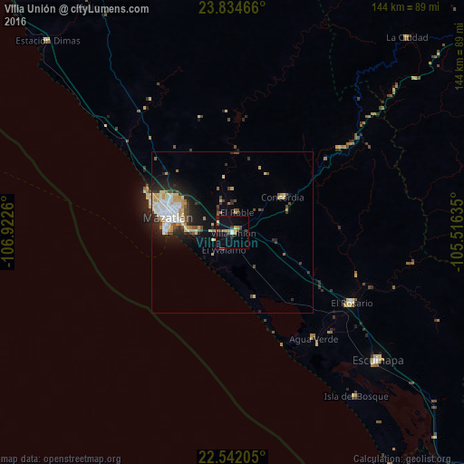
Analysis of Villa Unión night lights 2016
Square area 10x10 km:
 0.57%
0.57%90-99
1.52%80-89
1.7%70-79
2.27%60-69
2.84%50-59
3.79%40-49
1.14%30-39
1.7%20-29
1.52%10-19
7.95%0-9
75%Square area 50x50 km:
1.23%90-99
1.4%80-89
1.28%70-79
1.2%60-69
0.49%50-59
0.64%40-49
1.08%30-39
0.97%20-29
2.06%10-19
3.91%0-9
85.73%Clear (daylight) street map image can be seen on geolist.org.
Map coordinates:
23° 50' 4.8" North, 106° 55' 21.4" West
23° 11' 23.7" North, 106° 13' 10.1" West
22° 32' 31.4" North, 105° 30' 58.9" West
Some cities around Villa Unión sort by population:
• Mazatlán
19.7 km =12.2 mi,  284°
284°
• Escuinapa
60.2 km =37.4 mi,  131°
131°
• Pueblo Nuevo
88 km =54.7 mi,  76°
76°
• El Rosario
43.1 km =26.8 mi,  120°
120°
• Concordia
19.2 km =11.9 mi,  55°
55°
• Fraccionamiento los Ángeles
11.3 km =7 mi,  269°
269°
• Isla del Bosque
63.6 km =39.5 mi,  142°
142°
• Tayoltita
105.7 km =65.7 mi,  16°
16°
3980125 (p: 13,404)
Sources (retrieved 2019-11-25):
» Earth at Night: Flat Maps 2012, 2016