Villa Progreso night lights from space
Night Light of Villa Progreso (Querétaro) from space (Mexico) Src. Average luminocity for 10x10km area is 20.8333% and for 50x50km: 11.0336%.
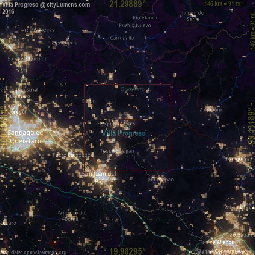
Analysis of Villa Progreso night lights 2016
Square area 10x10 km:
 0%
0%90-99
0%80-89
2.65%70-79
3.22%60-69
5.49%50-59
4.17%40-49
2.46%30-39
4.17%20-29
5.49%10-19
28.6%0-9
43.75%Square area 50x50 km:
0.18%90-99
0.44%80-89
1.7%70-79
1.47%60-69
2.35%50-59
1.4%40-49
2.28%30-39
2.28%20-29
3.34%10-19
9.99%0-9
74.57%Clear (daylight) street map image can be seen on geolist.org.
Map coordinates:
21° 17' 56" North, 100° 32' 17.3" West
20° 38' 32.4" North, 99° 50' 6" West
19° 58' 58.6" North, 99° 7' 54.8" West
Some cities around Villa Progreso sort by population:
• Tequisquiapan
14.6 km =9.1 mi,  203°
203°
• Ezequiel Montes
7.2 km =4.5 mi,  290°
290°
• Cadereyta
6.4 km =4 mi,  17°
17°
• Tecozautla
24.1 km =15 mi,  120°
120°
• La Valla
25.5 km =15.8 mi,  231°
231°
• San Nicolás
21.3 km =13.2 mi,  210°
210°
• La Llave
25.6 km =15.9 mi,  220°
220°
• Ajuchitlán
20.6 km =12.8 mi, 290°
3825909 (p: 5,604)
Sources (retrieved 2019-11-25):
» Earth at Night: Flat Maps 2012, 2016