Venustiano Carranza night lights from space
Night Light of Venustiano Carranza (Puebla) from space (Mexico) Src. Average luminocity for 10x10km area is 23.6761% and for 50x50km: 12.7827%.
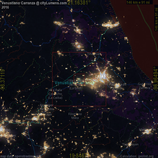
Analysis of Venustiano Carranza night lights 2016
Square area 10x10 km:
 0%
0%90-99
0.38%80-89
2.65%70-79
3.98%60-69
2.46%50-59
5.3%40-49
3.79%30-39
10.04%20-29
14.96%10-19
20.08%0-9
36.36%Square area 50x50 km:
0.78%90-99
1.25%80-89
1.85%70-79
1.6%60-69
2.31%50-59
2.2%40-49
3.45%30-39
3.34%20-29
3.92%10-19
5.79%0-9
73.52%Clear (daylight) street map image can be seen on geolist.org.
Map coordinates:
21° 9' 49.7" North, 98° 22' 16.3" West
20° 30' 24" North, 97° 40' 5" West
19° 50' 48.1" North, 96° 57' 53.8" West
Some cities around Venustiano Carranza sort by population:
• Poza Rica de Hidalgo
21.9 km =13.6 mi,  82°
82°
• Coatzintla
20.9 km =13 mi,  96°
96°
• Tihuatlan
27 km =16.8 mi,  31°
31°
• Villa Lázaro Cárdenas
6 km =3.7 mi,  213°
213°
• Plan de Ayala
21 km =13 mi, 77°
• Villa Avila Camacho
25.8 km =16 mi,  238°
238°
• Coyutla
28.9 km =18 mi,  177°
177°
• Totolapa
20.8 km =12.9 mi,  74°
74°
3818579 (p: 6,263)
Sources (retrieved 2019-11-25):
» Earth at Night: Flat Maps 2012, 2016