Villa Avila Camacho night lights from space
Night Light of Villa Avila Camacho (Puebla) from space (Mexico) Src. Average luminocity for 10x10km area is 4.5057% and for 50x50km: 5.4381%.
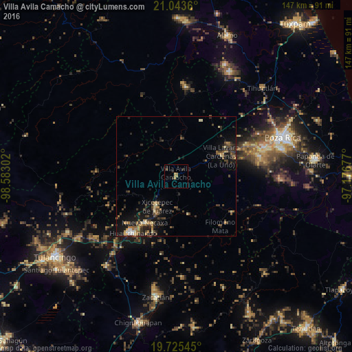
Analysis of Villa Avila Camacho night lights 2016
Square area 10x10 km:
 0%
0%90-99
0%80-89
0.76%70-79
1.33%60-69
1.7%50-59
0%40-49
0.76%30-39
1.52%20-29
1.52%10-19
0%0-9
92.42%Square area 50x50 km:
0.18%90-99
0.26%80-89
0.68%70-79
0.68%60-69
0.9%50-59
0.69%40-49
1.46%30-39
1.65%20-29
1.85%10-19
4.57%0-9
87.09%Clear (daylight) street map image can be seen on geolist.org.
Map coordinates:
21° 2' 37" North, 98° 34' 58.9" West
20° 23' 9.3" North, 97° 52' 47.6" West
19° 43' 31.6" North, 97° 10' 36.4" West
Some cities around Villa Avila Camacho sort by population:
• Xicotepec de Juárez
14.9 km =9.3 mi,  214°
214°
• Filomeno Mata
27.6 km =17.1 mi,  138°
138°
• Coyutla
27.8 km =17.3 mi,  123°
123°
• Necaxa
23.7 km =14.7 mi,  215°
215°
• Nuevo Necaxa
23.6 km =14.7 mi, 214°
• Tenango de las Flores
23 km =14.3 mi, 209°
• Venustiano Carranza
25.8 km =16 mi,  58°
58°
• Mecatlán
28.4 km =17.6 mi,  133°
133°
3761111 (p: 8,780)
Sources (retrieved 2019-11-25):
» Earth at Night: Flat Maps 2012, 2016