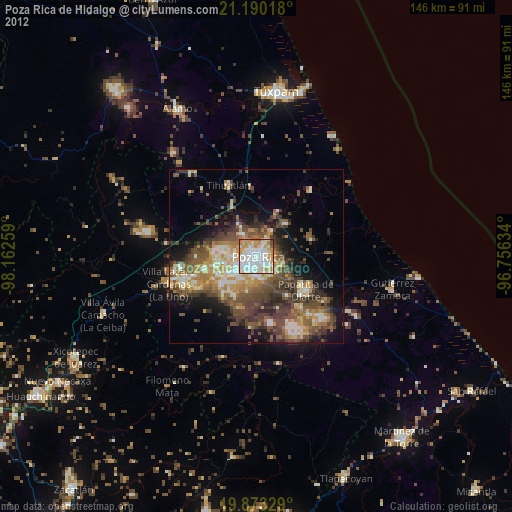
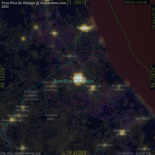
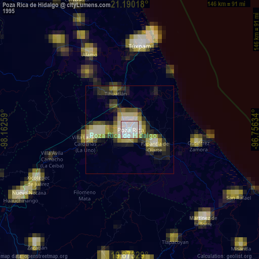
Poza Rica de Hidalgo night lights from space
Night Light of Poza Rica de Hidalgo (Veracruz) from space (Mexico) Src. Average luminocity for 10x10km area is 77.6345% and for 50x50km: 17.1154%.

Analysis of Poza Rica de Hidalgo night lights 2016
Square area 10x10 km:
 17.99%
90-99
19.51%80-89
18.94%70-79
10.42%60-69
8.33%50-59
11.93%40-49
6.82%30-39
3.41%20-29
2.65%10-19
0%0-9
0%Square area 50x50 km:
0.85%90-99
1.6%80-89
2.42%70-79
1.84%60-69
2.98%50-59
2.76%40-49
4.73%30-39
4.68%20-29
5.67%10-19
10.58%0-9
61.9%Clear (daylight) street map image can be seen on geolist.org.
Map coordinates:
21° 11' 24.6" North, 98° 9' 45.3" West
20° 31' 59.3" North, 97° 27' 34.1" West
19° 52' 23.8" North, 96° 45' 22.8" West
Some cities around Poza Rica de Hidalgo sort by population:
• Papantla de Olarte
17 km =10.6 mi,  124°
124°
• Coatzintla
5.2 km =3.2 mi,  190°
190°
• Tihuatlan
21.6 km =13.4 mi,  339°
339°
• Villa Lázaro Cárdenas
26.3 km =16.3 mi,  252°
252°
• Plan de Ayala
2.1 km =1.3 mi,  324°
324°
• Totolapa
3.3 km =2.1 mi,  327°
327°
• Venustiano Carranza
21.9 km =13.6 mi,  262°
262°
• Agua Dulce
25.6 km =15.9 mi,  137°
137°
3521168 (p: 185,242)
Sources (retrieved 2019-11-25):
» NASA, Earths city lights 1995
» NASA city lights 2003
» Earth at Night: Flat Maps 2012, 2016