Valentín Gómez Farías night lights from space
Night Light of Valentín Gómez Farías (Chihuahua) from space (Mexico) Src. Average luminocity for 10x10km area is 0.4246% and for 50x50km: 1.4232%.
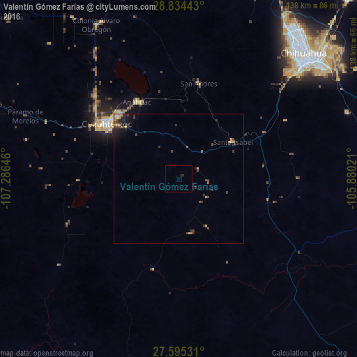
Analysis of Valentín Gómez Farías night lights 2016
Square area 10x10 km:
 0%
0%90-99
0%80-89
0%70-79
0%60-69
0%50-59
0%40-49
0%30-39
0%20-29
0.99%10-19
0.6%0-9
98.41%Square area 50x50 km:
0.02%90-99
0.05%80-89
0.26%70-79
0.28%60-69
0.04%50-59
0.19%40-49
0.38%30-39
0.57%20-29
0.61%10-19
0.87%0-9
96.72%Clear (daylight) street map image can be seen on geolist.org.
Map coordinates:
28° 50' 3.9" North, 107° 17' 11.3" West
28° 13' 0" North, 106° 34' 60" West
27° 35' 43.1" North, 105° 52' 48.8" West
Some cities around Valentín Gómez Farías sort by population:
• Chihuahua
67.1 km =41.7 mi,  46°
46°
• Cuauhtémoc
34.7 km =21.6 mi,  307°
307°
• Aldama
95 km =59 mi,  43°
43°
• Anáhuac
33.8 km =21 mi,  331°
331°
• La Junta
78.7 km =48.9 mi,  291°
291°
• Adolfo López Mateos
75.4 km =46.9 mi, 291°
• Guerrero
95.5 km =59.3 mi, 292°
• Santa Eulalia
79.9 km =49.6 mi,  58°
58°
3980683 (p: 5,404)
Sources (retrieved 2019-11-25):
» Earth at Night: Flat Maps 2012, 2016