Chihuahua night lights from space
Night Light of Chihuahua from space (Mexico) Src. Average luminocity for 10x10km area is 94.2254% and for 50x50km: 18.067%.
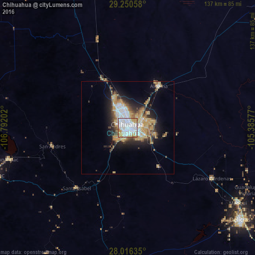

Analysis of Chihuahua night lights 2016
Square area 10x10 km:
 46.21%
90-99
31.25%80-89
8.52%70-79
11.74%60-69
2.27%50-59
0%40-49
0%30-39
0%20-29
0%10-19
0%0-9
0%Square area 50x50 km:
3.94%90-99
2.67%80-89
3.17%70-79
3.79%60-69
1.44%50-59
1.5%40-49
2.13%30-39
1.84%20-29
3.63%10-19
7.49%0-9
68.41%Clear (daylight) street map image can be seen on geolist.org.
Map coordinates:
29° 15' 2.1" North, 106° 47' 31.3" West
28° 38' 7" North, 106° 5' 20" West
28° 0' 58.9" North, 105° 23' 8.8" West
Some cities around Chihuahua sort by population:
• Meoqui
71.9 km =44.7 mi,  124°
124°
• Aldama
28.1 km =17.5 mi,  37°
37°
• Anáhuac
66.5 km =41.3 mi,  255°
255°
• Lázaro Cárdenas
53 km =32.9 mi, 120°
• Ampliación Colonia Lázaro Cárdenas
54 km =33.6 mi, 121°
• Santa Eulalia
20.1 km =12.5 mi,  103°
103°
• Rosales
72 km =44.7 mi,  133°
133°
• Valentín Gómez Farías
67.1 km =41.7 mi,  226°
226°
4014338 (p: 809,232)
Sources (retrieved 2019-11-25):
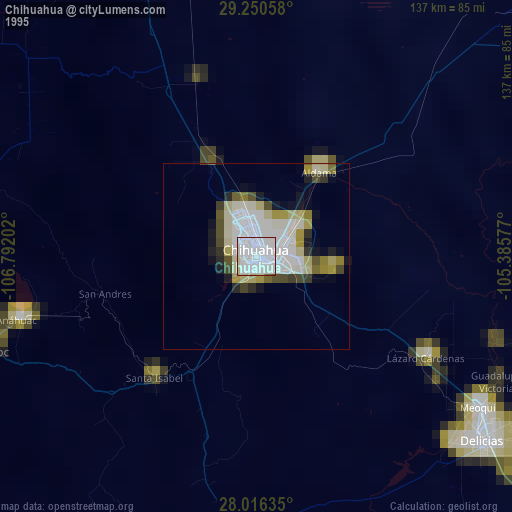
» NASA, Earths city lights 1995
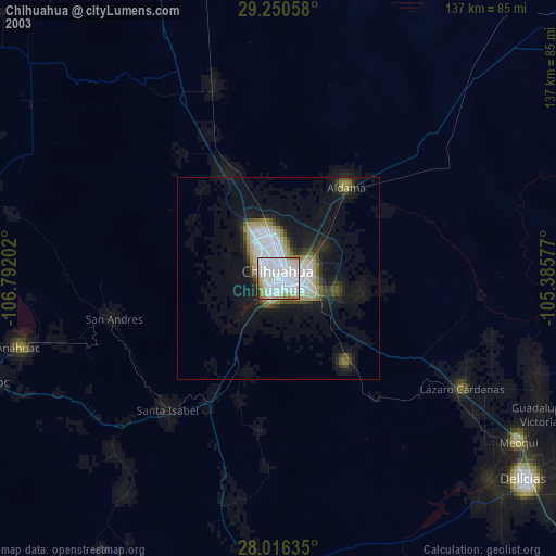
» NASA city lights 2003
» Earth at Night: Flat Maps 2012, 2016