La Junta night lights from space
Night Light of La Junta (Chihuahua) from space (Mexico) Src. Average luminocity for 10x10km area is 9.1607% and for 50x50km: 1.3228%.
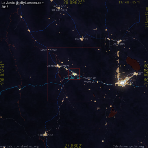
Analysis of La Junta night lights 2016
Square area 10x10 km:
 0%
0%90-99
0%80-89
2.78%70-79
3.37%60-69
0.99%50-59
1.19%40-49
1.19%30-39
1.39%20-29
0.2%10-19
0.79%0-9
88.1%Square area 50x50 km:
0%90-99
0.02%80-89
0.23%70-79
0.39%60-69
0.19%50-59
0.21%40-49
0.47%30-39
0.23%20-29
0.16%10-19
0.21%0-9
97.89%Clear (daylight) street map image can be seen on geolist.org.
Map coordinates:
29° 5' 46.5" North, 108° 1' 57.4" West
28° 28' 48.1" North, 107° 19' 46.1" West
27° 51' 36.7" North, 106° 37' 34.9" West
Some cities around La Junta sort by population:
• Cuauhtémoc
46.3 km =28.8 mi,  99°
99°
• San Juanito
62.4 km =38.8 mi,  205°
205°
• Anáhuac
56.9 km =35.4 mi,  89°
89°
• Adolfo López Mateos
3.2 km =2 mi,  117°
117°
• Guerrero
16.9 km =10.5 mi,  296°
296°
• Valentín Gómez Farías
78.7 km =48.9 mi,  111°
111°
• Gómez Farías
105.7 km =65.7 mi,  337°
337°
• Creel
86.5 km =53.7 mi,  200°
200°
4001792 (p: 8,930)
Sources (retrieved 2019-11-25):
» Earth at Night: Flat Maps 2012, 2016