Tultepec night lights from space
Night Light of Tultepec (México) from space (Mexico) Src. Average luminocity for 10x10km area is 94.2583% and for 50x50km: 74.6677%.
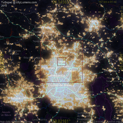
Analysis of Tultepec night lights 2016
Square area 10x10 km:
 42.15%
90-99
34.3%80-89
11.78%70-79
10.95%60-69
0.83%50-59
0%40-49
0%30-39
0%20-29
0%10-19
0%0-9
0%Square area 50x50 km:
25.54%90-99
13.98%80-89
12.08%70-79
12.92%60-69
10.88%50-59
6.2%40-49
4.69%30-39
4.27%20-29
5.03%10-19
2.78%0-9
1.65%Clear (daylight) street map image can be seen on geolist.org.
Map coordinates:
20° 20' 44.3" North, 99° 49' 52.3" West
19° 41' 6" North, 99° 7' 41" West
19° 1' 17.8" North, 98° 25' 29.8" West
Some cities around Tultepec sort by population:
• San Pablo de las Salinas
4 km =2.5 mi,  120°
120°
• Cuautitlán
5.7 km =3.5 mi,  253°
253°
• Fuentes del Valle
5.9 km =3.7 mi,  190°
190°
• Santiago Teyahualco
2.8 km =1.7 mi,  173°
173°
• Melchor Ocampo
2.6 km =1.6 mi,  316°
316°
• Tultitlán de Mariano Escobedo
6 km =3.7 mi,  224°
224°
• San Bartolo
6.1 km =3.8 mi,  327°
327°
• San Mateo Ixtacalco
4.8 km =3 mi,  289°
289°
3515044 (p: 65,338)
Sources (retrieved 2019-11-25):
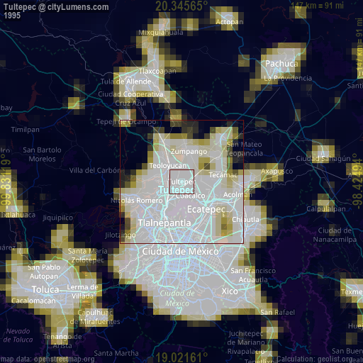
» NASA, Earths city lights 1995
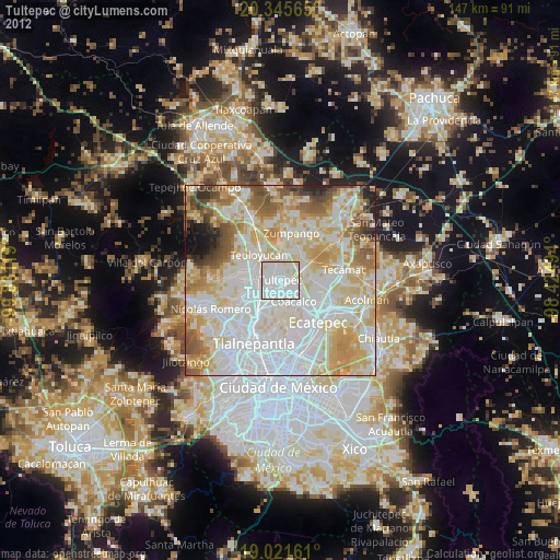
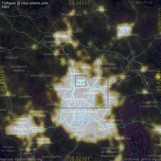
» NASA city lights 2003
» Earth at Night: Flat Maps 2012, 2016