Santiago Teyahualco night lights from space
Night Light of Santiago Teyahualco (México) from space (Mexico) Src. Average luminocity for 10x10km area is 97.3554% and for 50x50km: 77.3525%.
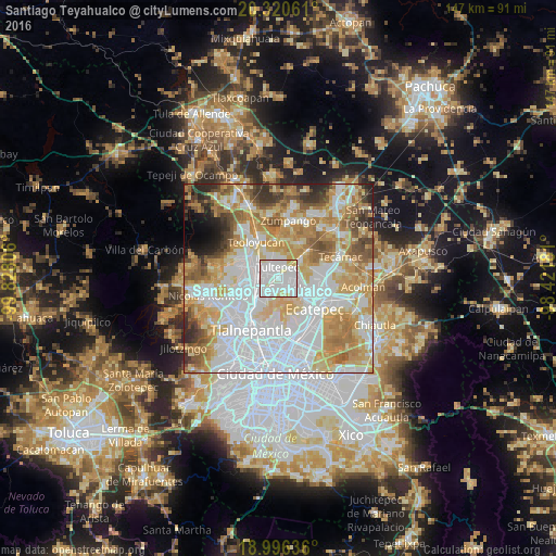
Analysis of Santiago Teyahualco night lights 2016
Square area 10x10 km:
 52.69%
90-99
36.57%80-89
8.47%70-79
2.27%60-69
0%50-59
0%40-49
0%30-39
0%20-29
0%10-19
0%0-9
0%Square area 50x50 km:
28.26%90-99
14.81%80-89
12.59%70-79
12.89%60-69
10.46%50-59
6.09%40-49
4.26%30-39
3.61%20-29
3.48%10-19
1.9%0-9
1.65%Clear (daylight) street map image can be seen on geolist.org.
Map coordinates:
20° 19' 14.2" North, 99° 49' 41" West
19° 39' 35.5" North, 99° 7' 29.7" West
18° 59' 46.9" North, 98° 25' 18.5" West
Some cities around Santiago Teyahualco sort by population:
• Coacalco
3.9 km =2.4 mi,  150°
150°
• San Pablo de las Salinas
3.2 km =2 mi,  76°
76°
• Fuentes del Valle
3.4 km =2.1 mi,  205°
205°
• Tultepec
2.8 km =1.7 mi,  353°
353°
• Melchor Ocampo
5.1 km =3.2 mi,  335°
335°
• Tultitlán de Mariano Escobedo
4.7 km =2.9 mi,  251°
251°
• Ampliación San Mateo (Colonia Solidaridad)
5.4 km =3.4 mi, 205°
• Alborada Jaltenco
5.9 km =3.7 mi,  87°
87°
3827596 (p: 53,684)
Sources (retrieved 2019-11-25):
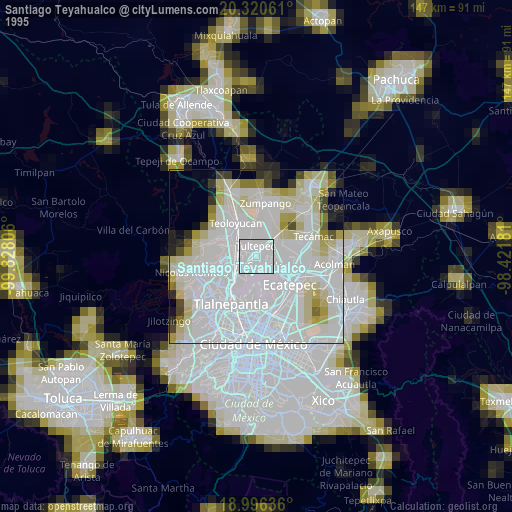
» NASA, Earths city lights 1995
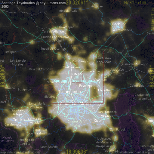
» NASA city lights 2003
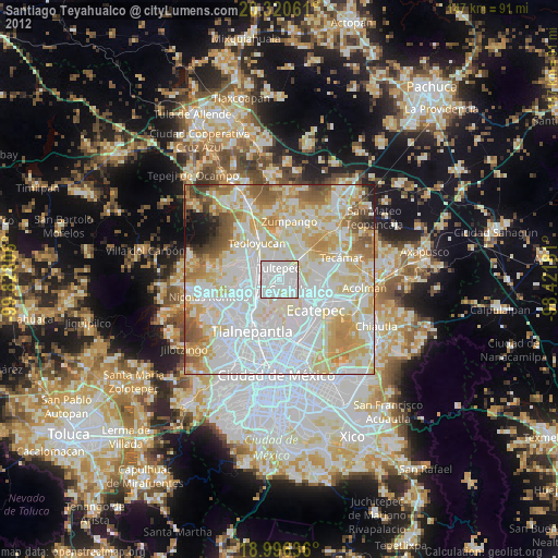
» Earth at Night: Flat Maps 2012, 2016