San Pablo de las Salinas night lights from space
Night Light of San Pablo de las Salinas (México) from space (Mexico) Src. Average luminocity for 10x10km area is 94.0702% and for 50x50km: 77.5958%.
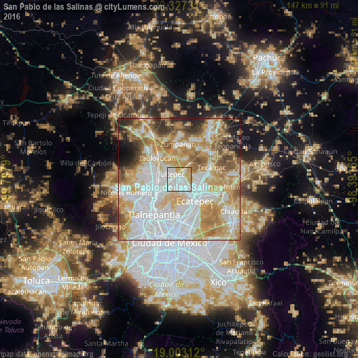
Analysis of San Pablo de las Salinas night lights 2016
Square area 10x10 km:
 45.66%
90-99
28.72%80-89
13.22%70-79
11.98%60-69
0.41%50-59
0%40-49
0%30-39
0%20-29
0%10-19
0%0-9
0%Square area 50x50 km:
27.88%90-99
14.94%80-89
13.08%70-79
13.37%60-69
10.2%50-59
6.05%40-49
3.91%30-39
3.19%20-29
3.99%10-19
2.78%0-9
0.6%Clear (daylight) street map image can be seen on geolist.org.
Map coordinates:
20° 19' 38.3" North, 99° 47' 52.4" West
19° 39' 59.7" North, 99° 5' 41.2" West
19° 0' 11.2" North, 98° 23' 29.9" West
Some cities around San Pablo de las Salinas sort by population:
• Coacalco
4.3 km =2.7 mi,  196°
196°
• Fuentes del Valle
6 km =3.7 mi,  230°
230°
• Tultepec
4 km =2.5 mi,  300°
300°
• Santiago Teyahualco
3.2 km =2 mi,  256°
256°
• Melchor Ocampo
6.5 km =4 mi,  306°
306°
• Alborada Jaltenco
2.8 km =1.7 mi,  100°
100°
• Tonanitla
4.9 km =3 mi,  61°
61°
• Ex-Hacienda Santa Inés
5 km =3.1 mi,  27°
27°
3518135 (p: 156,191)
Sources (retrieved 2019-11-25):
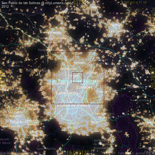
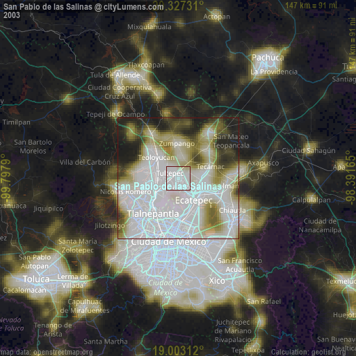
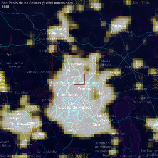
» NASA, Earths city lights 1995
» NASA city lights 2003
» Earth at Night: Flat Maps 2012, 2016